
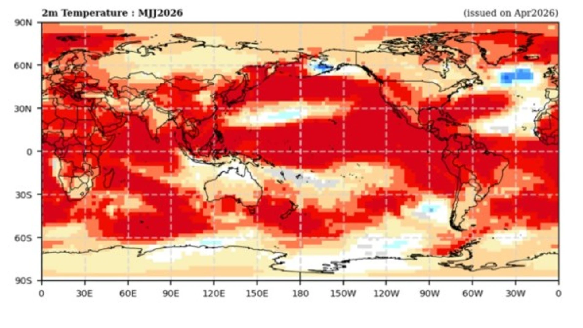
Major droughts and fires in Australia, monsoons with less rain in India and a significant drop in the level of fishing on the coasts of Chile or Peru. The world is preparing for the effects of El Niño, a cyclical phenomenon that, however, this year seems to be hitting the ground in a more intense way. At least that is what emerges from the latest update from the Climate Prediction Center of the US National Oceanic and Atmospheric Administration (NOAA), which estimates two out of three chances that El Niño will peak at very strong intensity.
This “Super Niño” will be fully felt next winter, although temperature anomalies are already detected in the Pacific waters, which are overheating. The alerts are global and, although the most affected areas of the world are in the tropics and on the Pacific coast, “El Niño modifies weather patterns throughout the world and affects countless sectors. It has effects on marine ecosystems; changes the upwelling of nutrients from the ocean floor and causes declines in fisheries productivity. It affects the sowing date in Africa and the cycles of vector diseases such as malaria in the Sahel area. Since there are fewer puddles, there are fewer mosquitoes and, therefore, a lower incidence of malaria has been studied in years under El Niño. However, in West Africa there is a much higher incidence of cardiovascular diseases due to heat. It even has influence on the stock market. When there is drought in Southeast Asia, there is less rice production and this food is essential for millions of people. These falls influence the international market, prices and imports and exports,” explains Belén Rodríguez de Fonseca, researcher in charge of the Excellent Research Group TROPA (Tropical Climate Variability and Atmospheric Teleconnections) at the Complutense University of Madrid. The researcher clarifies that this year there is a lot of consensus about the arrival of a strong event: «The measurements and models, some based on AI, point to an intense El Niño at the end of the year. The water has already risen three degrees and a mass as large as that of the Pacific at this temperature is capable of storing brutal energy and, when it is released, it will alter everything.
And, in addition to the effects described, El Niño is also behind the lower CO2 absorption capacity of the Amazon forests. «This increase in heat causes the vegetation to close its stomata to protect itself and not lose water, and to lose its absorption capacity. We can expect carbon dioxide levels on the planet to increase next year. We are also going to register more global temperature,” indicates Paloma Trascasa-Castro, researcher at the Department of Earth Sciences at the Barcelona Supercomputing Center-Centro Nacional de Supercomputación, who clarifies that in spring “there is a natural barrier of predictability due to the changing conditions of the atmosphere in March and April. However, in the latest predictions this month it is already quite certain that El Niño will reach a significant magnitude above two degrees. That is to say, the predictions are becoming more and more true,” he says.
In fact, several governments are already preparing for possible eventualities of an intense event. In Thailand, the government has already planned a pool of about 14 billion euros to grant loans intended to deal with the losses that this “Super Child” may cause. In India, for its part, solutions are being deployed that range from better water management to expansion of microirrigation systems for agriculture or crop diversification.
A wind swing
El Niño is a natural phenomenon that is followed by a neutral phase and its opposite, La Niña. «They are cycles that work like a seesaw. What happens is that La Niña is usually longer; The last one lasted three years and El Niño is usually stronger but lasts around twelve months. It disappears faster due to the natural mechanisms that the sea has to counteract all that excess heat,” explains Trascasa-Castro.
What causes this phenomenon? The trade winds from the equatorial Pacific, when blowing from east to west, carry surface water causing temperatures to be lower in the eastern Pacific than in the west. With El Niño, the trade wind weakens and all that water that is normally carried towards the Indonesian region moves towards Peru. The fishermen there called him that because he appeared at Christmas. For this reason, scientists expect that “next winter will be warmer than usual, the summer the same and the autumn will predictably be more unstable, but we are talking about 2027,” says Trascasa-Castro, who clarifies that their temperatures are related to the presence of an anticyclone in Europe that is blocking the entry of rain or wind, but “they are not due to El Niño.”
More and more super
It is not the first time that there has been evidence of a strong event. In fact, in recent decades there have been intense events between 1982-83, 1997-98, 2015-2016 and 2023. However, there is something that worries researchers and that is the impacts that this natural event may have in an increasingly hot atmosphere. «One reflection that is worth making is that these intense El Niño events previously occurred once every 10 or 12 years. The global warming process, as is known, is having a fairly strong impact on sea waters. Apart from the fact that the air temperature rises, what most worries climate research now is that the sea waters accumulate a lot of heat, and that heat, sooner or later, comes out and is reflected in the air temperature as well. Therefore, the more heat we accumulate in the seas, the more it means that the warming process will continue, it will last for many more years, because that heat that accumulates in the water has to go out into the atmosphere, into the air,” comments Jorge Olcina, professor of Regional Geographic Analysis at the University of Alicante.
There are more and more studies, indicates the researcher who point to the possibility of El Niño becoming more frequent. «We don’t know if the phenomenon itself will change much, but “We are certain that its impacts will be amplified in a warmer atmosphere,” For his part, Trascasa-Castro qualifies.
Comparable event?
Different publications talk about a catastrophic “Super Niño” in 1877 that could be replicated in the coming months. However, Belén Fonseca from the UCM clarifies that the “measurements then were made from boats, with a bucket and a thermometer. Since the 1980s, there has been an extensive network of buoys (called TOGA after the climate research program to which they belong) placed deep in the sea and satellites. that record what happens with ocean temperature. Dozens of research centers model and make predictions and, in addition, we have early warnings that make it impossible to compare the consequences of a distant episode,” he says.
A soccer World Cup with lethal heat
►The risk of playing the soccer World Cup, which starts in a few days, in more extreme heat conditions has almost doubled since the 1994 World Cup, according to a report. That of the World Weather Attribution (WWA) scientific group indicates that 26 matches will probably be played when the 26 degrees wet bulb globe temperature (WBGT) is exceeded, a threshold from which security measures are recommended. In addition to hydration stops, some experts suggest that we will see a more conservative way of playing due to climate change.