
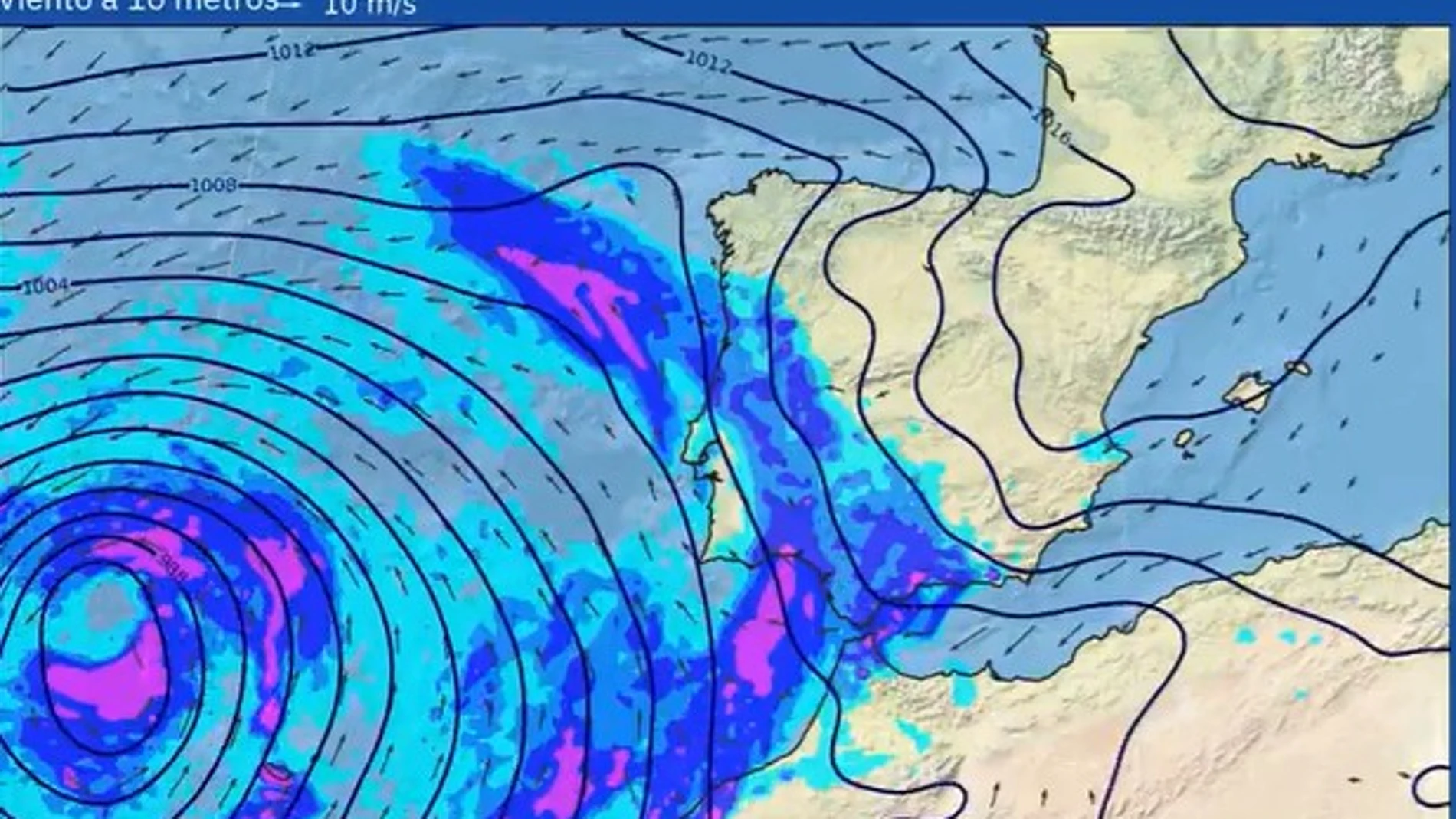
Storm Therese hits part of the country this Thursday, with Canary Islands yzOnas of Andalusia on orange alert (major risk) rain, wind and strong waves. Specifically, the Canary archipelago is facing an episode of intense rainfall, very strong gusts of wind and sea storms, while in Andalusia the risk is concentrated on the coast due to waves.
In addition, they are at the yellow level due to wind Cantabrian slope of Navarra and the Alava plain in the Basque Countrywhere they are expected gusts of between 70 and 80 kilometers per hour. In addition, Melilla It is at the yellow level due to coastal phenomena, with waves of 3 to 4 meters.
The storm will leave extraordinary rains in the Canary Islands during the episode, which could cause ravine flooding and landslidesaccording to the State Meteorological Agency (AEMET) on social network X. Some areas could receive “more water than falls all year”he adds.
According to the AEMET predictions for this Thursday, it is expected that yesand accumulate in the Canary Islands more than 80 liters per square meter in twelve hours in peaks and areas of the east, south and west of Gran Canaria, which is on orange alert.
The gusts of wind will reach intensities of up to 90 kilometers per hour, even surpassing 100 kilometers per hour, in La Palma and north of Tenerife; Likewise, they will be very strong in the summits of Gran Canaria, which has activated orange level alerts.
In addition, the west of La Palma and the island of Hierro are on orange alert due to coastal phenomena, with waves of 5 to 6 meters. The Canary archipelago is also on alert, although yellow, due to snow in the north of Tenerife and in the peaks of La Palma. There will be significant accumulations above 1,800/2,000 meters.
Areas of Andalusia on alert
On the peninsula, the storm mainly affects the extreme south, although with less intensity than in the Canary Islands. Andalusia maintains the orange alert due to maritime storms on the coast of Grenade and in Almería capital and the westwith waves of between 3 and 4 meters. Furthermore, the provinces of Almería, Cádiz and Málaga They are under a yellow warning due to easterly winds of up to 80 kilometers per houras well as by coastal phenomena in the case of Cádiz and Málaga.
Education and teleworking: measures in the face of the storm
Given the intensity of the storm, the Ministry of Education has decided suspend in-person classes this Thursday in Tenerife, La Palma, La Gomera, El Hierro and La Graciosawhere the teaching activity will move to telematic mode.
The suspension extends to Gran Canaria this afternoon, and to the rest of the archipelago starting Fridaywith the aim of avoiding displacements that could put the population at risk, especially the educational community. Educational centers will remain closed.
For its part, The Cabildo of Tenerife has recommended activating teleworking andn all non-essential services for this Thursday and Friday, a measure that extends to both public administrations and the private sector. Its president, Rosa Dávila, has insisted on the need to restrict mobility on the island as much as possible.
In recent hours, strong gusts of wind have caused incidents such as street lamp fall on the TF-highway5, which hit a vehicle without causing injuries, although it did cause significant delays near the Los Rodeos airport. Furthermore, the Council agreed to suspension of cultural, sports and public events starting at midnight.
Therese will continue spanking on Friday
During Friday, rainfall will extend to the eastern islands, especially south of Gran Canaria, where it could be heavy and persistent in the morning. A new front band will increase instability in the western islands, with locally intense showers and storms in La Palma and Tenerife. The wind will blow from the southwest with gusts of up to 90 km/h on summits and leeward areasand the maritime storm will continue with waves greater than 4 meters.
It is expected that the situation of adverse weather continues over the weekend, with persistent rains in the midlands, summits and southwest slopes, while the wind will remain intense on Saturday and will tend to subside on Sunday, although strong gusts could be recorded on exposed coastlines and summits.