
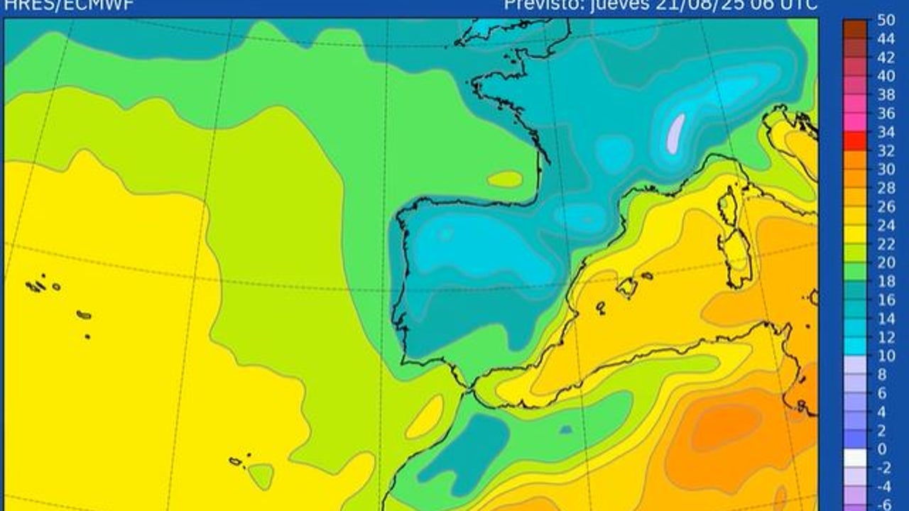
During the day Sunday the temperatures were extremely high in large areas of the Peninsula and Balearic Islands. Six stations six stations of the Network of the State Meteorology Agency (Aemet), all in Andalusia, exceeded 45 degrees and 239 distributed throughout the country registered at least 40 degrees
After more than two weeks of extreme heat, This Monday the heat wave comes. The entrance of a tape tall by the Peninsular Northwest will leave instability in the northern half, a noble decrease in temperatures and the Return of the rains to several areas of the country. According to José Luis Camacho, spokesman for the AEMET, this heat wave, with 16 days, will probably be placed as The longest third since there are records, drawing with August 2022.
Showers, storms and strong wind
The coolest air in the west in low layers, anger, moving to overheated air and has helped the propagation of fire in many peninsular areas, although In the southeast quadrant of the Peninsula and in the Balearic Islands the thermal relief will wait.
Despite this change in the weather pattern, the Aemet today maintains red notices in southeast areas, such as Las Vegas del Segura (Murcia), where temperatures are expected close to 44 ° C, and on the southern coast of Alicante, with maximums close to 42 ° C. There are also Orange notices in Andalusia, Murcia, the southeast of Castilla-La Mancha and Balearicas.
Meteorology foresees Locally strong showers and storms, especially in Pyrenees and Eastern Iberian and Mountainous Areas of the East. In the Pyrenees of Lleida, orange level notice has been issued for storms and for rainfall that can accumulate more than 30 liters per square meter in 24 hours.
In areas of Aragon, Interior of Catalonia, Interior of Valencia, South of Albacete and Interior of Murcia and Guadix-Baza Storms with strong wind gusts can occur.
Thermal descent and rains continue
This Tuesday, with the advance of the trough east, the definitive closure of the heat wave episode is expected, with a remarkable drop in temperatures in the southeast and this peninsular thirds. The moderate heat will persist, but almost without any area will be notice by maximum temperatures.
That day is expected Chubascos and locally strong storms with very strong gusts in Pyrenees, Eastern Iberian and intermediate areas.
For Wednesday, the AEMET provides that the peninsular north will continue under the influence of Atlantic circulation, with rains that will be more abundant and persistent in the Eastern Cantabrian, and locally strong and the east interior of Catalonia. The almost generalized temperature decrease will continue.