
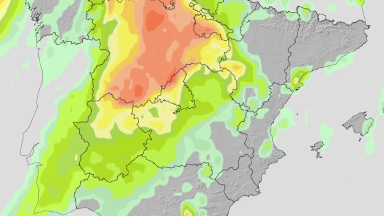
The forecast of the State Meteorology Agency (AEMET) for this Friday, September 19 announces a day marked by instability in the peninsular north and persistent heat in the south and the Canary Islands. Spain will remain under the influence of a mass of subtropical air, which will bring variable cloudiness, punctually strong storms and suspension dust.
During the first half of the day, abundant cloudiness of a medium and high type is expected, which will advance from south to north in much of the Peninsula, except on the eastern facade, where the skies will remain more clear.
With the passage of the hours, heat and humidity will favor the development of cloudiness of evolution in the plateau and mountainous areas, as well as in the high Ebro and west areas. This will translate into storms accompanied by showers, which could be locally strong on the northern plateau, the north of the Iberian system and the high Ebro, at risk of very intense winding.
In the Canary Islands, the appearance of some occasional storm is not ruled out in summit areas, accompanied by cloudiness and suspension dust. In addition, the calima will be intense in the archipelago, with the possibility of extending to a lesser extent to the south and west peninsular.
Intense heat in the south and minimum rebound
The maximum temperatures will descend generalized in the Peninsula, except in Galicia and the Canary Islands, where they will remain unchanged. Despite this, the heat will continue to press in several zones: 35 degrees will be exceeded in the Canary Islands and in the southern half of the Atlantic aspect, reaching even 38 degrees in the depressions of the Guadalquivir and Guadiana.
In the north, the thermometers can also reach high figures: up to 35 degrees at points of the Northern Plateau, southern Galicia, Eastern Cantabrian and the Ebro Valley.
The minimums will rise in the west and the peninsular center-center, maintaining without major changes in the rest. They will not fall from 20 degrees in the Mediterranean, under Ebro and much of the southwest quadrant, and even in the Canary Islands there will be areas that do not descend from 25 degrees, which guarantees another tropical night in the archipelago.
Calima and wind in different areas
Calima will be one of the most prominent phenomena of the day, especially in the Canary Islands, where the concentrations will be significant, although it could also be noticed in the southern and west peninsular.
As for the wind, it will blow with greater intensity in the coastlines of the southern peninsular, Cádiz and South of the Balearic Islands, with strong gusts in the Strait. In the Canary Islands, the winds of the East and Northeast will predominate, while in the Peninsula there will be variable predominance according to the area: North and West in the Cantabrian, South and West on the North Plateau and Galicia, and East and South in other regions.
In summary, on Friday it will leave two different realities in Spain: in the north, the arrival of strong storms at risk of intense wind gusts; and in the south and the Canary Islands, a new day of extreme heat and persistent calima. One day that confirms the changing nature of this September.