
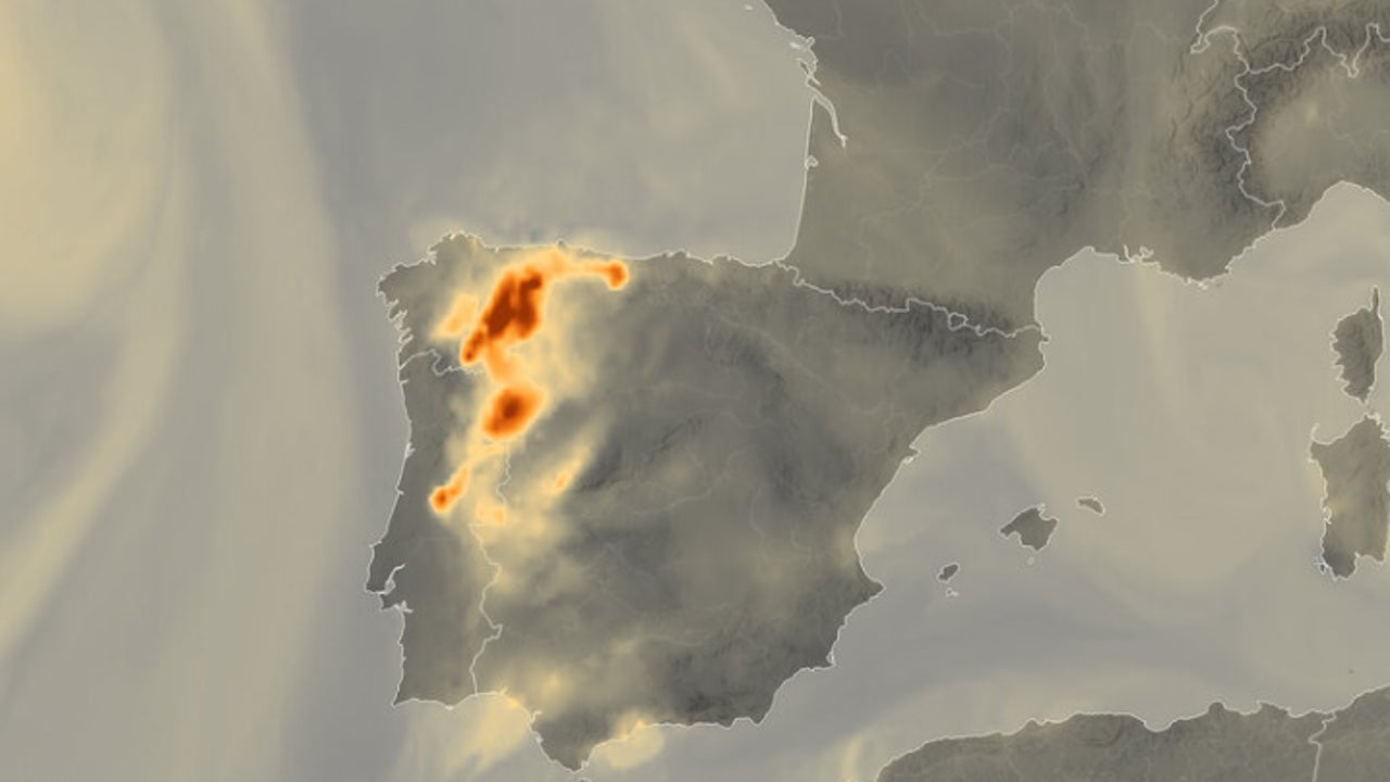
Fire is recognized as an essential climatic variable, since it plays a fundamental role in the terrestrial system by influencing the composition of the atmosphere, carbon cycles and ecosystems. To better understand and supervise these relationships, ESA (European Space Agency) He has used satellite observations for his new XFIRES project. In recent days, high temperatures and extreme drought of the land have fueled forest fires, which have spread throughout the Iberian Peninsula.
From the orbit, the earth’s observation satellites offer a unique way to follow the propagation of fires and help emergency equipment fighting against the flames on the ground. The images published by ESA REVAN The magnitude of the crisis, with dense columns of smoke from several fires that extend through large areas of northwest of Spain and northern Portugal.
To help, the Copernicus Emergency Cartography Service of the European Union for several of these fires has been activated, as well as for recent fires in other parts of Europe. This service uses satellite images and other geospatial data to Prepare free maps and quick response for catastrophe situations worldwidevital tools that help emergency organizations to coordinate their response, support recovery and plan future risks.
Although currently the service mainly uses Very high resolution satellite images to respond to fires in Spain and Portugal, The Copernicus Sentinel-3 and Sentinel-2 missions offer a broader vision, with a coherent surveillance and a large scale of fire activity and its impact throughout the region.
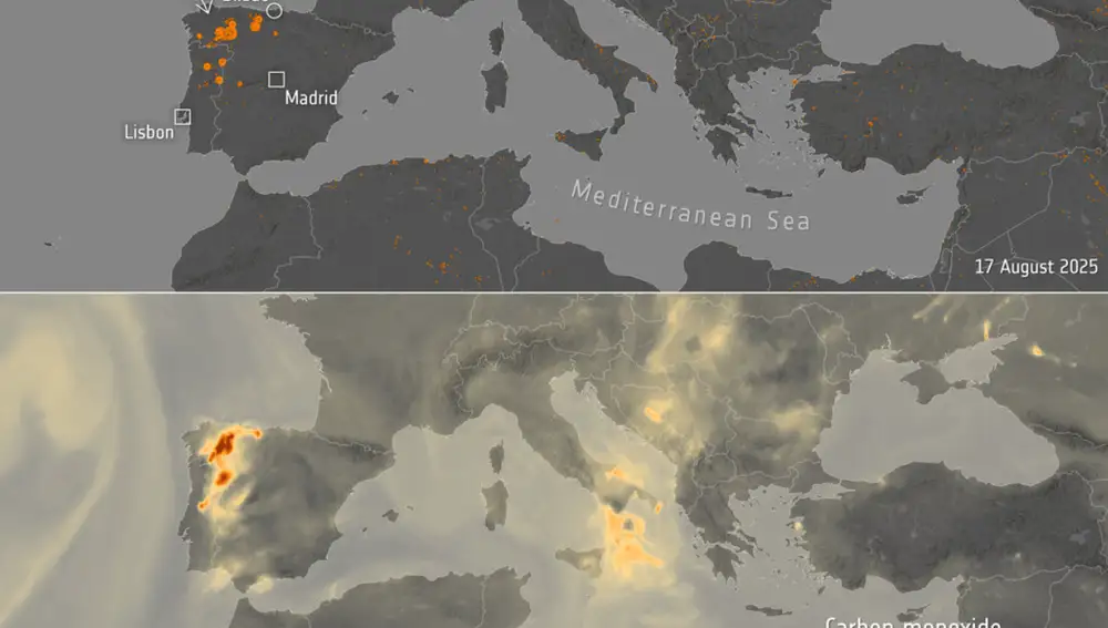
The first image was captured by the Mission Copernicus Sentinel-3 on August 17, 2025. This wide view of France, Spain and Portugal is dominated by the smoke that rises from fires in the northern part of the Iberian Peninsula.
Dense columns of smoke can be seen, moving north and east under the dominant winds, merging with cloud systems on the Atlantic and covering a large part of the Vizcaya Gulf. Part of this smoke that It is heading north is also being pushed back into the Mediterranean coast of Spain.
Forest fires like these not only They endanger lives and devasta fauna, habitats, agriculture and property, but also seriously degrade air quality, which aggravates its impact on human health.
Critical points are classified according to their radiative power using visible and infrared image radiometer data (VIIRS), aboard the Somi National Polar-Fithing Partnership, NOAA-20 and NOAA-20 and NOAA-21, a collaboration between NASA and NOAA.
The carbon monoxide map, the following image, is based on data from the Atmospheric Surveillance Service (CAMS) of the European Commission. Based on satellite data, the CAMS provides information related to air pollution and health, solar energy, greenhouse gases and climate forcing worldwide.
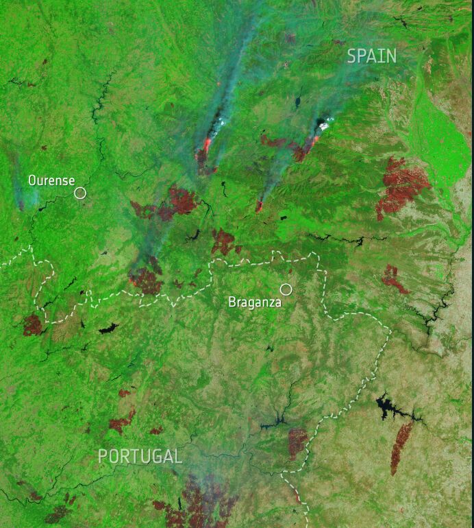
The final image, obtained on August 16 by the Copernicus Sentinel-2 mission, is A false color view that uses the short wave infrared channel to highlight the active fires in the northeast of Portugal and northwest Spain. There is also a real color version, which allows you to observe closer to the affected areas.
While immediate priority in any forest fire crisis is to extinguish the flames and protect communities, The long -term challenge is that these phenomena are expected to be increasingly frequent and intense as the climate crisis aggravates.