
The week starts with more intense downpours in the Canary Islands for the storm Theresewhich will continue to leave cloudy skies and abundant rainfallespecially on the southern slopes of the most mountainous islands. In the rest of Spain, cloudy skies are expected, although with less likely rain. According to the prediction of the State Meteorological Agency (AEMET)locally strong showers are not ruled out in Lanzarote and Fuerteventura, where storms could also appear.
Temperatures in the archipelago will hardly vary, with maximums around 22ºC and minimums of 17ºC. The wind will blow from the south with strong intervals in the eastern province and in Tenerife, while in the western islands it will be weaker and more variable.
On the Peninsula, the situation will be more stable, although with some cloudy intervals. A small instability will affect the northeastduring the first half of the day, leaving scattered rainfall. Low clouds are also expected in the Mediterranean area in the afternoon and on the Cantabrian slope in the morning. In the Balearic Islands, some light rain is not ruled out, while in the rest, slightly cloudy or clear skies will predominate, with possible morning mists and mists in the Cantabrian Sea and the Pyrenees.
Maximum temperatures will decrease in the northern plateau, the Balearic Islands, the east and northeast of the peninsula and will rise in the south and southwest, with general values between 18 and 20 ºC. The minimums will drop in the western half and will remain below 10 ºC in much of the territory. The wind will generally be weak from the north in the interior, with greater intensity on the Galician coast and Ampurdán, as well as moderate gales in the Ebro valley.
Time turn starting Wednesday
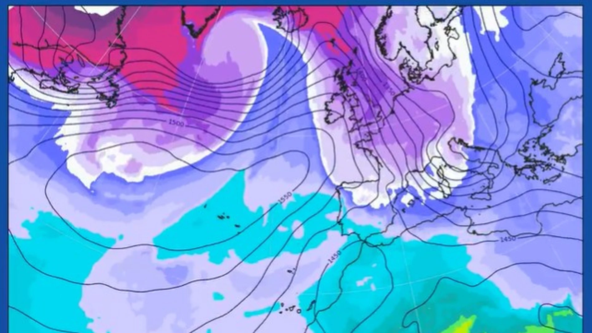
Starting Wednesday, the weather outlook will change noticeably. According to the Meteored portal, a deep trough very cold air will descend over Europe, favoring the formation of several storms. This situation will cause entry of a polar air mass over Spaina, with winds from the north and northeast component in the second half of the week.
However, the meteorological portal warns that the meteorological models still present discrepancies about the intensity and extent of this episodeas well as the possible influence of the remains of Storm Therese, which could leave some showers in Andalusia before dissipating.
Easter with a winter atmosphere
If this scenario comes true, Meteored points out that the Easter week could start with a marked temperature drop and an environment more typical of winter. The arrival of cold air would place the isotherm of -4ºC about 1500 m reaching the center and north of peninsular Spain, as well as the Balearic Islands.
The snowfall could be significant in the Cantabrian Mountains, the Pyrenees and the northern Iberian system between Thursday and Monday, with the possibility of reaching low levels. They could also be recorded in the Central System and other mountainous areas of the interior.
The rains would be concentrated on the Cantabrian slopewith important accumulations, while they are also expected showers in the Balearic Islands, the south of the Gulf of Valencia, the Region of Murcia and the east of Andalusiato. It could even snow in high areas in the north of the province of Alicante and in the Tramuntana mountains, in Mallorca.
He Palm Sunday could be especially cold, with temperatures maximums that would barely reach 8 or 9 ºC in cities such as Burgos, Pamplona, Segovia, Soria, Teruel or Vitoria, according to Meteored. The frosts would gain extension, potentially drop below 0 ºC in some inland capitals. Even so, other models propose a more moderate scenario, with the outbreak of cold air limited to the north, east and the Balearic Islands, and of lower intensity.