
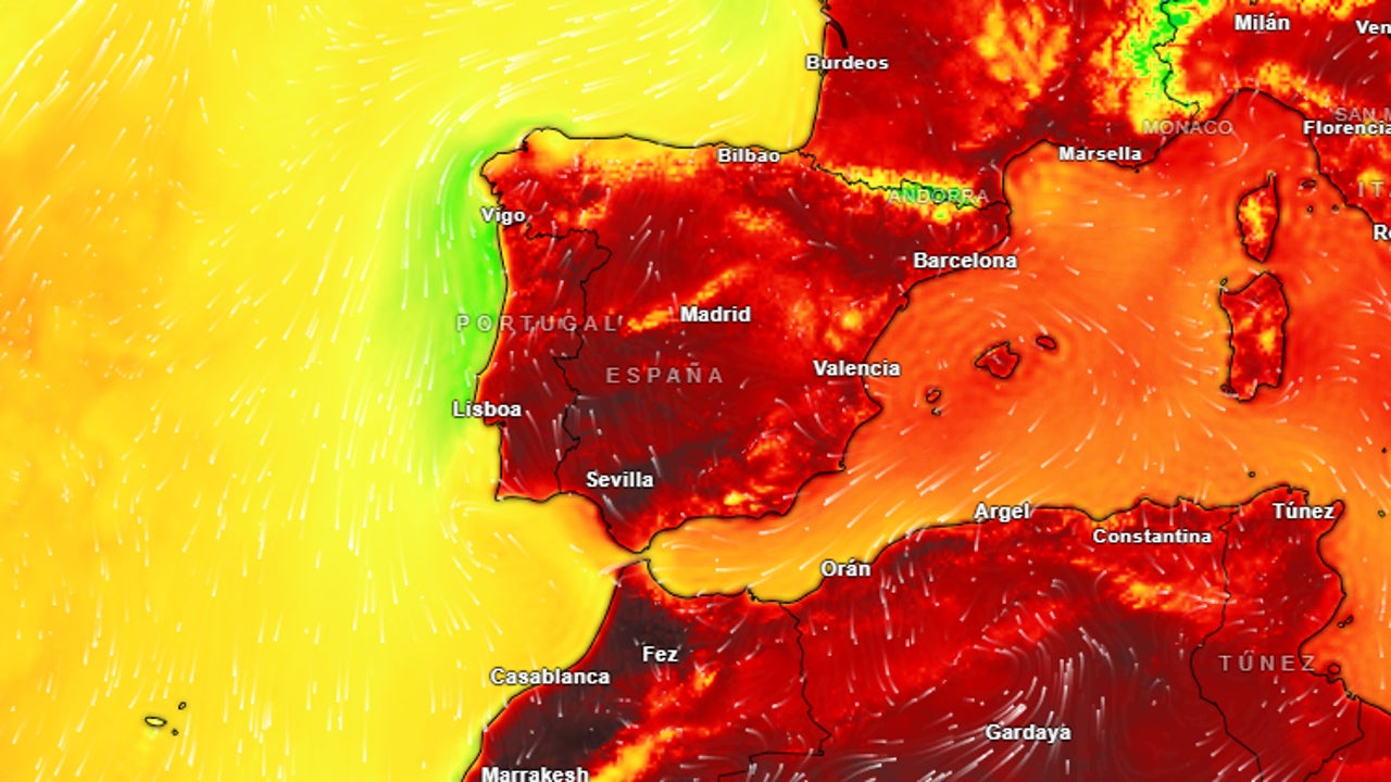
Today August 14, 2025, the high pressures In the northern peninsular will generate a flow of the northeast that will leave weak rains and morning mists in the Cantabrian and Galiciaalthough the heat will dominate the day: the maxims will reach 40 ° C. in valleys of Guadiana and Guadalquivirsurpassing the 35 ° C. in the half south of the peninsula, Northeastern depressions, Balearic Islands and Canary Islands. The nights will remain tropical, with minimal above 25 ° C. in it Mediterranean, Canary Islands and areas of. Southwest Atlanticaggravated by Calima In the archipelago canary.
Adverse phenomena in the Pyrenees and Northeast
In the afternoon, instability will trigger storms “locally strong” in the Pyrenees, Iberian and Northeast Systemthat could be accompanied by hail and very intense wind gusts capable of causing specific damage. These storms will extend dispersed inside Catalonia and Aragonwhile Balearics will register only high clouds and northern Canary Islands It will be cloudy without significant rainfall.
This scenario is part of a summer of global climatic records, linked to 422.8 ppm of atmospheric co₂, which intensifies the persistence of anticyclones. While Spain suffers the second heat wave of the summer, Phoenix (USA) touches the 45 ° C. and Sonora (Mexico) faces flooding for the Ivo cycloneevidencing Synchronized extreme patterns In the western hemisphere.
The winds will complicate the situation: they will blow Moderate alisios with strong streaks in Canary Islands, Intense lift in it Narrow and North component in Galicia and the Cantabrian. Fourteen communities keep active alerts, being Andalusia, Catalonia, Galicia and Estremadura at orange risk (high) by heat, while Aragon and Catalonia They add notices for storms. The authorities recommend avoiding outdoor activities between 12:00 and 6:00 p.m., especially in thermal risk areas such as Cordovawhere the UV index will reach levels critics.