
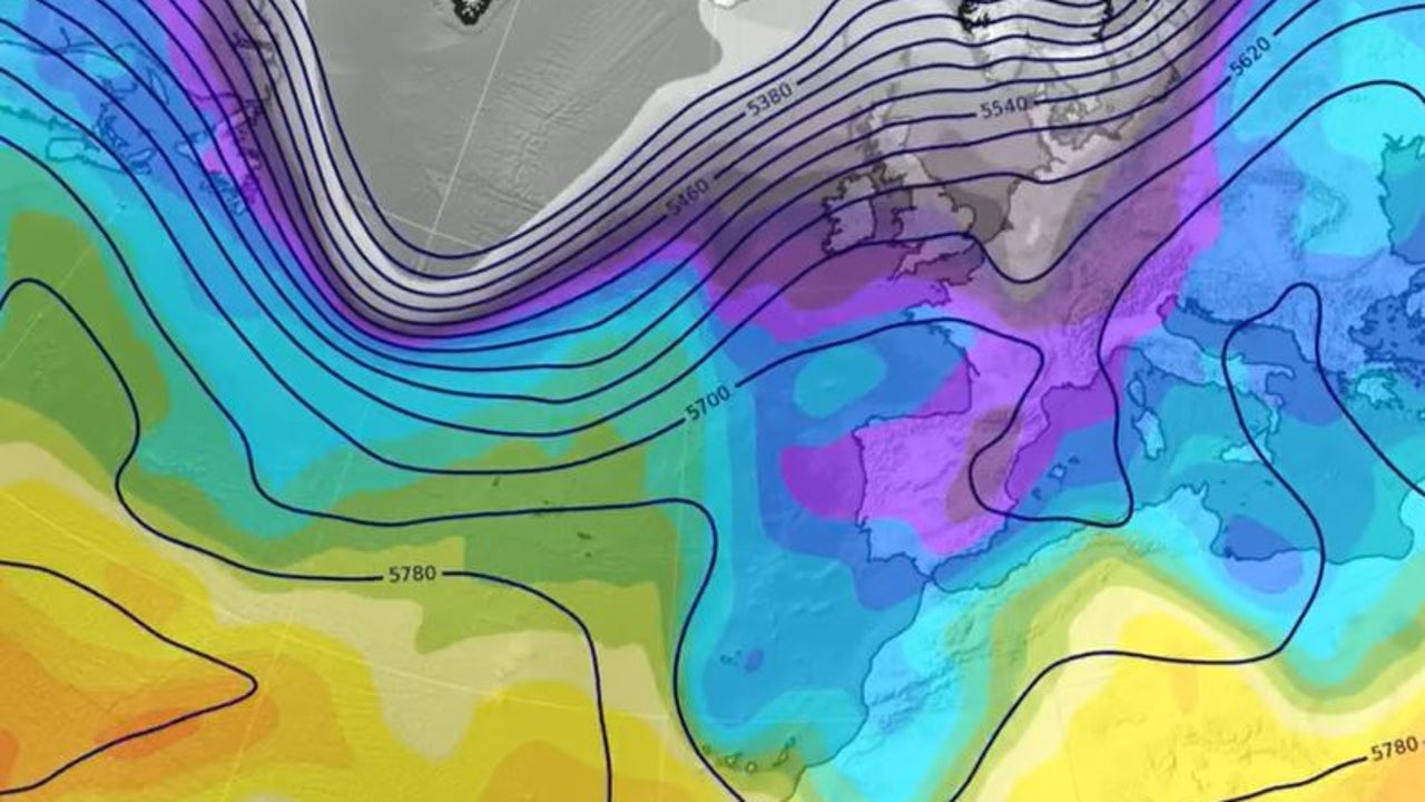
A front will bring rain this Thursday to the northwest of the Peninsula, and on Friday it is expected that rainfall extends to much of the countryincluding the Balearic Islands. On the weekend, uThe new DANA will cross Spain from north to south leaving precipitation in many areas.Temperatures will drop on Friday and snowfall is expected in mountainous areas.
In the last few hours, unstable weather has dominated in the east of the Peninsula and the Balearic Islands, with intense showers in the south of Catalonia, the Valencian Community, the Region of Murcia and the Balearic Islands. This Thursday, there will still be lmorning rains in the Mediterraneanbut they will decrease.
A front enters Galicia with more rain
However, the State Meteorological Agency (AEMET) announces the arrival of a new Atlantic front throughout the day that will leave rainfall in the northwest, particularly in Galiciawhere it will rain heavily in the west. Also planned arerains in Asturias, Castilla y León, and possibly in central areas.
As for temperatures, they will remain stable, except in the Cantabrian Sea, where the south wind will significantly raise the values. The provincial capitals that will register the highest values will be Badajoz and Santa Cruz de Tenerife with 27ºC; Córdoba, Las Palmas de Gran Canaria and Seville with 26ºC; and Almería, Bilbao, Granada, Murcia and Palma with 25ºC. In addition, intervals of strong wind are expected in the north of Galicia, the Cantabrian Sea and the Strait.
Collapse of temperatures
On Friday, the front will cross the Peninsula from west to east, leaving widespread rains that will also reach the Balearic Islands. The most intense will occur in the north, while the snow level will drop from 2,500 to between 1,200 and 1,600 meters. The northwest winds will bring cold air and cause temperatures to drop, especially in Galicia, the Cantabrian Sea and Castilla y León.where they could drop to 6 or 8 degrees, leaving a cool environment. On the other hand, the east will be warmer, with Girona, Murcia and Valencia exceeding 25°C.
A new DANA threatens Spain this weekend
On Saturday, the thermal drop will extend to the east of the peninsula and the Balearic Islands, with significant drops of up to 8 degreess. an eThe cold air pocket will be isolated from the general circulation, leading to the formation of a DANA. that will approach our environment, with rain and showers starting on Saturday, although with uncertainty still about the areas with the highest probability, warns the AEMET.
According to tiempo.es, DANA is expected to reach the northwest of the Peninsula during Friday night. Throughout Saturday and Sunday, it would advance south, moving through the west of the territory until reaching the Gulf of Cádiz, where it could remain stationed on Monday of next week.
The meteorological portal advances that rains are expected in large regions of the country. On Saturday, rainfall will be more notable in the western half of the peninsula, while on Sunday it will intensify in the southern third, with a new rebound in areas of the Mediterranean. The areas with the greatest accumulation of rain will include the north and west of Galicia, parts of southern Andalusia, as well as the northeast of the peninsula, where the north of Aragon, Catalonia and the Valencian coast stand out.
For next week, the AEMET predicts rain in the north, and, once again, there is uncertainty in the forecast regarding the situation in the east of the peninsula and in the Balearic Islands, where showers cannot be ruled out. Temperatures will barely vary on Monday and Tuesday.