
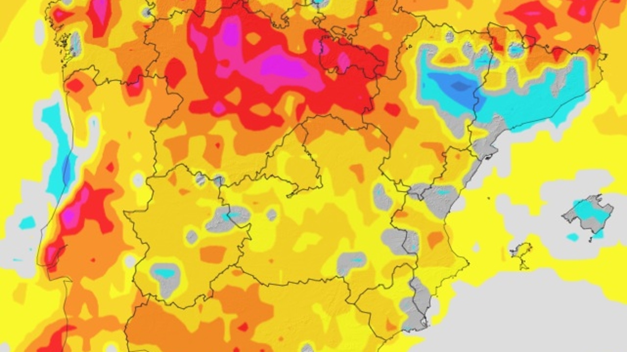
The forecast of the State Meteorology Agency (AEMET) for this Thursday, September 18 anticipates a day marked by intense heat and generalized stability in most of the country. However, not everything will be calm: Canary Islands will live a complicated day with calima, high temperatures and risk of storms in the islands of greater relief, while in the southwest peninsular the 38-40 degrees will be exceeded in the depressions of the Guadalquivir and Guadiana.
The day will begin with a predominance of little cloudy skies or cleared in almost the entire territory. Only in the north and this peninsular thirds, as well as in the Balearic Islands, Strait and Alborán, a morning low cloudiness is expected with probable fog banks and coastal mists, which will tend to dissipate with the passage of the hours.
In the afternoon, the warmer and more humid air will favor the formation of evolution clouds in the southwest quadrant of the peninsula, with the possibility of isolated storms in mountain areas. In the Canary Islands, in addition to the calima, showers or storms are not ruled out in the islands of greater relief, especially in high areas.
Suffocating heat in the southwest and rebound in the north
The maximum temperatures will continue to rise in much of the Peninsula and the Canary Islands, with more accused promotions in the Cantabrian, where the heat will be noted even inside. On the contrary, in the Levante there will be slight descents that will relieve the situation.
The most extreme values will be reached in the Guadalquivir and Guadiana Valley, where the thermometers will mark between 38 and 40 degrees. The 35 degrees in the Canary Islands, the high and a half Ebro, the south of Galicia, areas of the northern plateau and in much of the southern Atlantic aspect will also be exceeded.
The minimums will also rise in the Peninsula and the Canary Islands, maintaining the warm nights. In the Mediterranean, under Ebro and Southwest Peninsular will not fall from the 20 degrees, and even in the Canary Islands there will be areas that do not descend from the 25 degrees, which guarantees a especially difficult night to sleep.
Calima in the Canary Islands and changing wind
Calima will be one of the most prominent phenomena in the Canary Islands, with significant concentrations of suspension dust that will affect visibility and air quality.
As for the wind, they will blow the east component in the coastlines of the Southeast and the Strait, where they can reach strong intervals. In the Canary Islands, loose to moderate winds are expected, while in the rest of the country the lazy ones will predominate, with southern and west component in the Atlantic aspect and this in the rest. The Cantabrian and the Ebro could register moderate intervals.
In short, on Thursday, September 18, it is presented with a divided Spain between generalized stability and extreme phenomena: suffocating heat waves in the southwest peninsular, calima and storms in the Canary Islands, and notable thermal promotions in the Cantabrian. An more reminder that the month of September can still bring intense summer episodes mixed with the beginning of autumnal instability.