
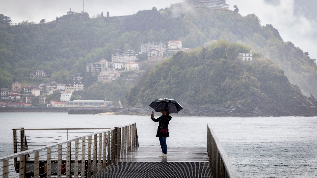
This weekend astorm will be dropped from Greenland to Galicia to leave rainfall of different intensity in much of the country. Its showers will be almost widespread and could be accompanied by storms in some areas. In addition to rain, snowfall in mountain areas and strong winds are also expected. Temperatures will continue to be cool for the time of year.
This Thursday will be a transition daywith increasing cloud cover in most of the country and weak rainfall in the north of Galicia and the Cantabrian slope that will extend throughout the day to the rest of Galicia, upper Ebro, Iberian system, Pyrenees and northern Catalonia and the Northern plateau, according to the prediction of the State Meteorological Agency (AEMET).
Scattered and occasional rainfall is not ruled out in other regions of the northern half of the peninsula. In the southeast they may be accompanied by a storm at the end of the day and may be in the form of snow in the Pyrenees and, less likely, in other mountains in the northern half. The snow level will be at 1,200/1,400 meters and will rise to 1,500/1,700 in the extreme north, from 1,200/1,400 to 1,600/1,800 in northern Iberia and 1,600/2,000 in the rest.
Minimum temperatures will rise throughout the country except in the southwest of the peninsula and in the Canary Islands, where they will decrease. Light frosts are expected in the Pyrenees, northern Iberia and Cantabria and are not ruled out in surrounding areas.
The maximums will tend to rise in the Alborán, the southeast quadrant of the peninsula, the Pyrenees and the north of the Balearic Islands, while they will decrease in the rest of the territory, more markedly in the northwest of the peninsula. The highest values in the entire country will be recorded in Córdoba, Huelva and Seville (27ºC); Málaga and Murcia (25ºC) and Santa Cruz de Tenerife (24ºC).
The moderate trade wind will blow in the Canary Islands, the southern and eastern component winds will predominate in the Levant, and the northern and western component winds will predominate in the rest. In general, the winds will be weak, with more intense intervals on the coasts, Ebro, southwest of the peninsula and in the Strait and Alborán, where it will blow from the west.
Tomorrow's weather: precipitation and snow
On Friday andhe center of the storm will be located off the coast of Galicia and will leave rain in the Cantabrian Sea, Alto Ebro, in Castilla y León and in the surroundings of the Centra Systeml. These precipitations could extend further to the east and south without reaching the Mediterranean today. The snow level will drop to 1,000 meters in the Cantabrian mountain range. As for temperatures, they will rise in the north and east of the Peninsula and fall in the southwest. It will be warmer in the southern third of the peninsula with a maximum of around 25ºC.
On Saturday one of the storm fronts will cross the peninsula. There will be rain in almost the entire territory, although throughout the afternoon, it will subside.. In this way, on Saturday rains in the form of showers will be more likely around the Pyrenees, the Cantabrian Sea, North Castilla y León, around the Central System and the Strait Area, where they are more likely to be intense. In the Valencian Community, the Region of Murcia and Eastern Andalusia the probability of rain will be very low. Likewise, the snow level will be around 1,000 to 1,200 m in the northwest of the Peninsula and around 1,500 to 1,800 m in the east.
Daytime temperatures will drop in much of the country except in the Mediterranean and the Eastern Cantabrian Sea, where they will rise. Specifically, Bilbao will exceed 20ºC and cities like Valencia or Murcia will exceed 25ºC while capitals like Lugo or León will not reach 15ºC. Meanwhile, the minimums will decrease in the west and rise in the east. The wind will blow in much of the country during the day with strong intervals in coastal areas and even very strong in the northern mountains.
The storm will move away on Sunday towards the British Isles, although the unstable weather will continue. There is a possibility of showers, especially Catalonia and the Balearic Islands, where they could also be intense. In turn, other points in the eastern peninsula and the Mediterranean area could register rainfall. Night temperatures will drop and it could freeze again in mountain areas of the northern peninsula, in isolated points of the northern plateau and central moors. The maximums will rise, especially in the west of the peninsula, but they will fall in the Mediterranean and the Balearic Islands.
The weather for the May long weekend
Looking ahead to next week, instability is likely to continue. On Monday it could rain in Catalonia and other areas of the eastern peninsula and On Tuesday a new front could arrive from the northwest. In general, temperatures will be higher at the beginning of the week.