
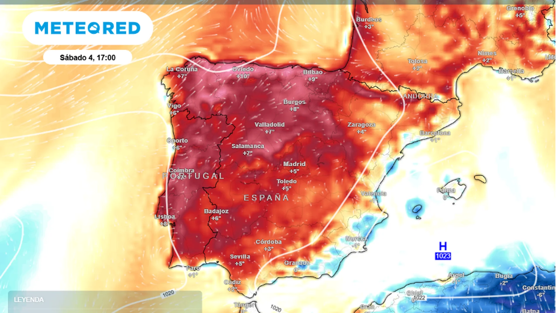
The Easter 2026 is leaving an extreme weather scenario that will force you to change your wardrobe in record time. According to Meteored, Spain is going through a radical transition: from a purely winter environment due to the entry of polar air, we move to a almost summer situation in just 48 hours. This atmospheric variability is causing Thermal contrasts of up to 20 ºC between day and night in the interior of the peninsula.
After a start to the week with intense wind and precipitation, the atmosphere begins to stabilize thanks to the advance of a subtropical ridge. Meteored experts confirm that this rise will be especially notable in the south and the Guadalquivir valley.
This Tuesday, cities like Badajoz, Córdoba, Huelva, Murcia and Seville will already exceed 25 ºC, with values that will touch 30 ºC in areas of the Guadalquivir valley. In much of the country, temperatures will exceed 20ºC during the central hours of the day. However, at dawn the thermometers will drop below 10 ºC in much of the interior and some points on the coast.
The exception: strong winds and rain
However, not all of Spain enjoys stable weather. Eight autonomous communities are today under warning due to strong winds and/or maritime storms, with Balearic Islands, Catalonia and Aragon in orange level (significant risk) due to gusts that can reach 100km/h in the Pyrenees of Huesca and Ampurdán (Girona), in addition to strong waves in the first two.Canary Islands It is added as the ninth community in yellow level due to suspended dust and significant haze, according to the AEMET.
In other areas under warning, gusts of 70-90 km/h are recorded, such as in the central system of Ávila and Segovia, the mountains of Madrid, Navarra, the banks of the Ebro in La Rioja and the province of Castellón. Furthermore, the Balearic Islands and Catalonia could experience waves of up to 11 meterswhile in Empordán waves of up to 10 meters are expected, which maintains the alert for coastal phenomena and wind in much of the country. They are also planned Weak but persistent rainfall in the Cantabrian Sea, the Pyrenees and the upper Ebro.
Forecast for Holy Thursday and Easter weekend
A very similar situation will continue on Wednesday. The wind will blow with intensity again in the northeast of the peninsula and the Balearic Islandswith poor sea conditions, while the rains will continue to be limited to the Cantabrian Sea, the Pyrenees and the upper Ebro. On the other hand, a Mediterranean storm The possibility of showers in the Balearic Islands will increase, without also ruling out the possibility of showers in the east of Catalonia. Temperatures will experience few changes and thermal amplitudes will continue to be pronounced.
Facing Maundy Thursdayweak rains are expected in the Cantabrian Sea and the Pyrenees, while in the Balearic Islands they will subside. Maximum temperatures will rise again in the south and northeast, reaching between 25 and 29 ºC in cities like Badajoz, Huelva, Málaga or Seville.
During the easter weekendthe subtropical ridge will finish imposing itself and the situation will tend to stabilize even more, with temperatures between 20 and 25 ºC in most of the country, and exceeding 25 ºC in several regions.