
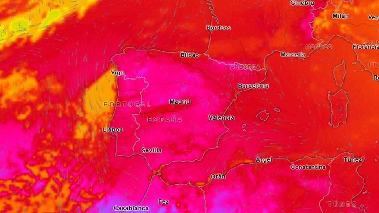
The State Meteorology Agency (Aemet) alert that this August 7 will mark the most intense day of the current heat wave, with temperatures that will reach the 40-42 ° C in the Guadalquivir Valley, Extremadura and Interior areas of Andalusia. Extreme heat will affect almost the entire peninsula, with generalized maxims above 36 ° C. and especially high values in the Eastern Cantabrian, where notable thermal ascents will be produced.
Dangerous storms in the south
While heat squeezes, the Central Bética It will be the scene of locally strong storms during the afternoon, accompanied by hail and very intense wind gusts that could overcome the 80 km/h. These storms could affect areas of Córdoba, Jaén and Grenadeat risk of material damage and interruptions in the electricity supply. In it Pyrenees and northeast peninsular Some scattered showers are also expected, although of less intensity.
Tropical and calm nights
The nights will continue to offer little relief: temperatures minimal will remain exceptionally high, without going down from 25 ° C. In many areas of the Mediterranean and Guadalquivir Valley. To this situation is added the presence of Calima in the South Peninsular and Canary Islandswhich will reduce visibility and could affect people with respiratory problems. Morning fog banks in the Peninsular Northwest They will be another outstanding phenomenon in this day of meteorological ends.
Aemet confirms that heat wave will last at least until Tuesday, August 12with possible records of 42-44 ° C. next week in the south and northeast peninsular. Civil protection keeps alerts in 13 communities and insists on constant hydration, avoid outdoor activities between 12:00 and 6:00 p.m., and extreme surveillance with children, elders and chronic patients.