
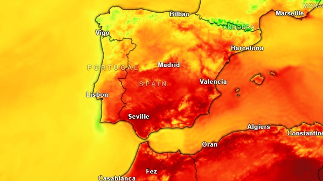
This Saturday, August 30, it will be a stable day in most of the country: the increase in temperatures will be practically generalized, except on the Mediterranean coast, and the 32 degrees Celsius will be exceeded in large part of the southern half and 34 and 36 degrees in the Guadalquivir and inside the Region of Murcia.
Clear skies will be seen with high cloud intervals moving from west to east, although it is likely to see mists and morning mists in Galicia, in the Cantabrian mountain range and in the west of the northern plateau. These clouds can be persistent in Rías Baixas, with morning weak rains in Galicia and surrounding, as well as at the eastern end of the Cantabrian and on the north face of the Pyrenees.
All this is what the forecast of the State Meteorology Agency (Aemet) says for this Saturday, August 30. The month is about to say goodbye and today does it with few rains, but rainfall is planned to return on Sunday with a new front that will enter Galicia, through the Cantabrian and Pyrenees communities, although showers will also be seen in other areas of the northern third.
Alisio will blow in the Canary Islands and Western and Southwest wind in Galicia and Cantabrian, both with probable intervals of Fuerte. Moderate west in the Strait and Alborán tending to the variable, and winds from lazy to moderate, also from variable direction, in the rest of the Mediterranean. In the rest of the Peninsula, winds will predominate, in general lazy, west component.
Fire hazards
For this Saturday, August 30, the Aemet does not keep any meteorological notice active, the result of stability provided in much of the territory. Yes, remember the danger of fires to increase temperatures: very high or extreme levels especially in areas of the northwest, center and half south of the territory.
In large part of Galicia and Cantabrian communities, as well as in the Peninsular Northeast, the danger levels will be generally or moderate, although they will remain very high in areas of the Galician community and Asturias.