
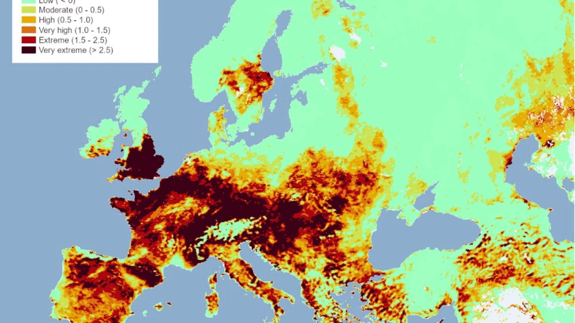
For centuries we have been accustomed to maps that give information about the past or the present. Then we got the idea of “maps of the future”: what the continents will be like in millions of years, the state of the roads in a certain week or the weather at a precise location and date. These latest maps help us anticipate. but there is a cartography that we need to avoid a possible future. And one of those maps is the one published by the Joint Research Center (JRC) of the European Commission.
And reading it has led them to issue a warning regarding the high risk of forest fires expected for this weekend in large areas of the south of the continent. Spain, Portugal, southern France, Italy, Greece and other Mediterranean regions appear with very high or extreme levels of danger, in a summer that is already one of the toughest in recent years.
“A wide area of western and central Europe is affected by extreme conditions, with the greatest concentration in France and the Alpine arc that extends to northern Italy, as well as in the British Isles and Ireland – notes the statement -. These Areas are also affected by extreme conditions, spanning the Iberian Peninsula, the Balkans and parts of North Africa”.
The tool used by the European Commission to create this map is part of the European Forest Fire Information System (EFFIS), integrated into the European Copernicus program (European Space Agency satellites) and developed by the Joint Research Center (JRC). Each day combines observations by satellite, weather models and data on the state of vegetation to calculate fire danger across the continent.
The system does not try to figure out where a fire will start, that would be impossible. What he calculates is something different: if that fire were to occur, would it be easy to spread? The difference is important. Because A poorly extinguished cigarette butt or lightning can cause a fire almost any day in the summer. What turns that small focus into an emergency is the environment around it. To answer that question, scientists analyze several ingredients at the same time: air temperature, humidity, wind speed and direction, rainfall in recent weeks and, mainly, the state of the vegetation.
A rainy winter can encourage the growth of shrubs and herbs. Months later, a succession of heat waves turns that vegetation into a huge deposit of dry fuel. If the wind also blows, the flames can advance very quickly. It is exactly the combination that is worrying this summer in much of Europe. After months of abundant plant growth, extreme heat and dryness have left millions of hectares in conditions especially favorable for the spread of fire.
All this information is transformed into an indicator known as the Fire Weather Index (FWI), originally developed in Canada and today adopted by numerous forest services around the world. The index does not measure the probability that someone will cause a fire, it measures how that fire would behave if it appeared. The higher the value, The easier the vegetation will burn, the faster the flames will advance and the more difficult it will be to contain them.
When the map turns dark red, emergency services know that any fire can become a large fire in a very short time. But once a fire is declared, another part of the European system comes into play. Copernicus satellites locate active hotspots, delimit burned surfaces and generate emergency maps that help teams on the ground. They even allow estimating the emissions of carbon dioxide, particles and other pollutants released into the atmosphere.
It is information that is used by both the firefighting services and the authorities in charge of coordinating the response between different European countries. So, The objective of these maps is not to predict the future accurately, rather it is to gain time. Know several days in advance which regions will need more surveillance, where it is advisable to reinforce the means of extinction or when it is advisable to restrict certain activities in the forest.