
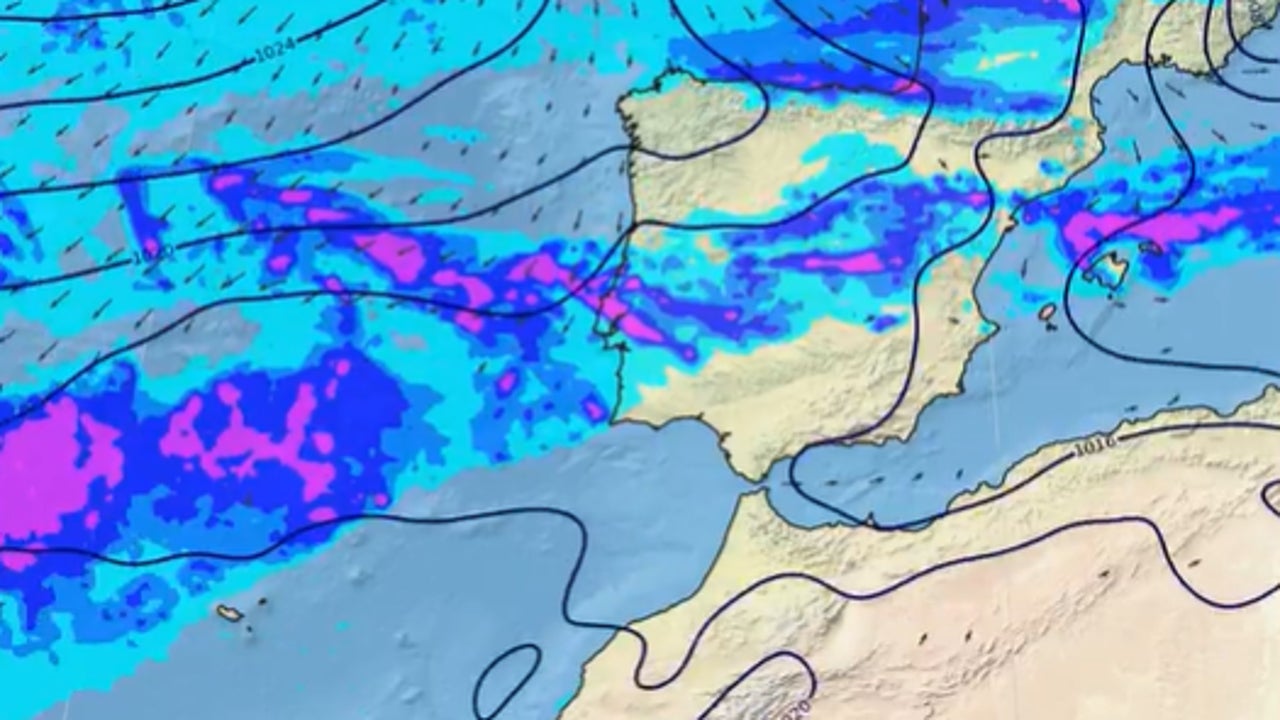
The passage of fronts associated with Atlantic storms will give rise to rainfall in the west, center and north of the peninsula, more abundant in Galicia. Temperatures will be higher than normal for the time of year, especially mid-week, when 32/34 degrees can be exceeded in the south of the country. YoYou could even have tropical nights on the shores of the Mediterraneanhas advanced Rubén Del Campo, spokesperson for the State Meteorological Agency (AEMET).
Very intense rains in these areas and atypical heat
He Tuesday It is very rainy in Galicia, with stormy showers and significant accumulations of precipitation, especially in the Rías Baixas. Precipitation will extend to Cantabrian communities, Castilla y León, Extremadura, northern Andalusia and points in the central area. Despite the instability, temperatures will rise slightly, with a very mild environment. In the Guadalquivir Valley and in the Mediterranean area, maximum temperatures of 28 to 30 degrees are expected.
He Wednesday the rain will be the protagonist again Galiciaespecially in the west of the community. Precipitation could reach other areas of the northern third, the west of the peninsula, as well as the center and east of Andalusiawithout reaching the Mediterranean or the Balearic Islands. This day a notable thermal rise is expected, with maximums that could reach 30-32 degrees in cities in the east and south of the peninsula such as Córdoba, Seville, Murcia, Valencia or Alicante. Tropical nights, those in which it does not drop below 20 degrees, could reappear in coastal areas of the Mediterranean.
He Thursday and Friday the abundant rains will continue in Galicia, extending to the Cantabrian communities and in the north of Castilla y León. in addition to mountain areas such as the Montes de León, the northern Iberian System and the Cantabrian Mountains. During these days, temperatures will continue to be very high for the season, reaching between 5 and 10 degrees above normal. In southern and eastern parts of the peninsula, cities such as Murcia, Seville, Córdoba or Granada will reach or exceed 32 to 34 degreeswith new tropical nights on the Mediterranean coasts.
Cooler and rainier weekend
Although there is uncertainty in the prediction, the models point to a generalized thermal drop during the weekendaccompanied by rains that would affect large areas of the country, with a special impact on the northern third of the peninsula.
The formation of a DANA is not ruled out
For its part, Meteored indicates that several atmospheric rivers, strips of subtropical humidity, will impact the peninsula, leaving very intense rains in the northeast. The Atlantic circulation will persist for much of the week, although starting on Saturday the polar jet will present undulations that They will give rise to troughs, without completely ruling out the formation of a dana.
In Galicia, the highest accumulations are expected, with more than 200 l/m² in Pontevedra and occasionally up to 300 l/m², while in Ourense, Lugo and A Coruña it will exceed 100 l/m². The European model also foresees abundant rains in mountainous areas in the west of Zamora and Orense, and in the southwest of Asturias.
In some regions of Burgos similar records could be reached, although with greater uncertainty. In the Aragonese and Navarrese Pyrenees, as well as in the Iberian Peninsula of Rioja and Soriana, accumulations greater than 50-60 l/m² are expected in the areas most exposed to the southwest flow.