
Spain begins the week with a clearly autumnal atmosphere, marked by a accused thermal descent that will leave temperatures between 5 and 10 degrees below the usual for these dates until Thursday, especially in the northern half, according to the prediction of the spokesman of the State Meteorology Agency (Aemet), Rubén del Campo.
The minimums will be especially cold. In interior areas such as Teruel, Soria, Salamanca, León or Ávila are expected dawns below 5ºC. In León, for example, On Wednesday there will be minimal of just 2ºC, while Soria will touch the frost with 1ºC.
In the extreme peninsular, the atmosphere will be fully autumn. In large areas of Castilla y León and the north third, the maxims will barely reach 18 or 20 degrees. The thermal contrast with the south of the country will be marked: in the Guadalquivir Valley and the peninsular southeast, the 30ºC will still be exceeded.
Intense rains and first snows
In addition to the cold, the meteorological instability will also star in the start of the week. This Monday will be very rainy in the Cantabrian, where there will be locally strong storms, as well as in areas of Catalonia and the Balearic Islands. In these last two regions, the rains will tend to refer in the afternoon.
In the peninsular southeast, From 10 pm, alerts for rainfall and storms in the region of Murcia will be activatedbefore the forecast of accumulations in an hour of up to 20 liters per square meter, As in Almería, in Andalusia.
The Aemet stressed that at points of the Pyrenees and the Cantabrian mountain range you can see the first snowflakes of autumn. This will happen above 1,600 to 2,000 meters (m) altitude. In the rest, the heavens will be little cloudy, although storms in the afternoon can be formed in areas of the east peninsular.
Tuesday and Wednesday: cold, wind and more rains in the Mediterranean
Tuesday will be another fresh day for the time, with temperatures below normal in much of the country. The rains will persist in the north and the northeast, and the wind will blow from the north with force in the northern peninsular half increasing the feeling of cold.
Wednesday will further descend night temperatures, while daytime will remain unchanged. With respect to the rains, in the northern half they will be generally scarce, while in the Mediterranean, especially in Catalonia and the Balearic Islands, the showers will persist, which could be locally strong.
Thermal rebound from Thursday
As of Thursday, a progressive promotion of temperatures is expected, so Facing the weekend, daytime values would even be high for the time. From the field warns that The 30ºC could be exceeded at points of the peninsular northeastern and in large areas of the center and south of the peninsula. In the Guadalquivir, 32 to 34ºC could be exceeded.
Initially, rainfall will be scarce, although they could take weakly in points of the Peninsular Mediterranean and Balearic Islands and in Galicia, in this case by the arrival of a front.
Hurricane Gabrielle
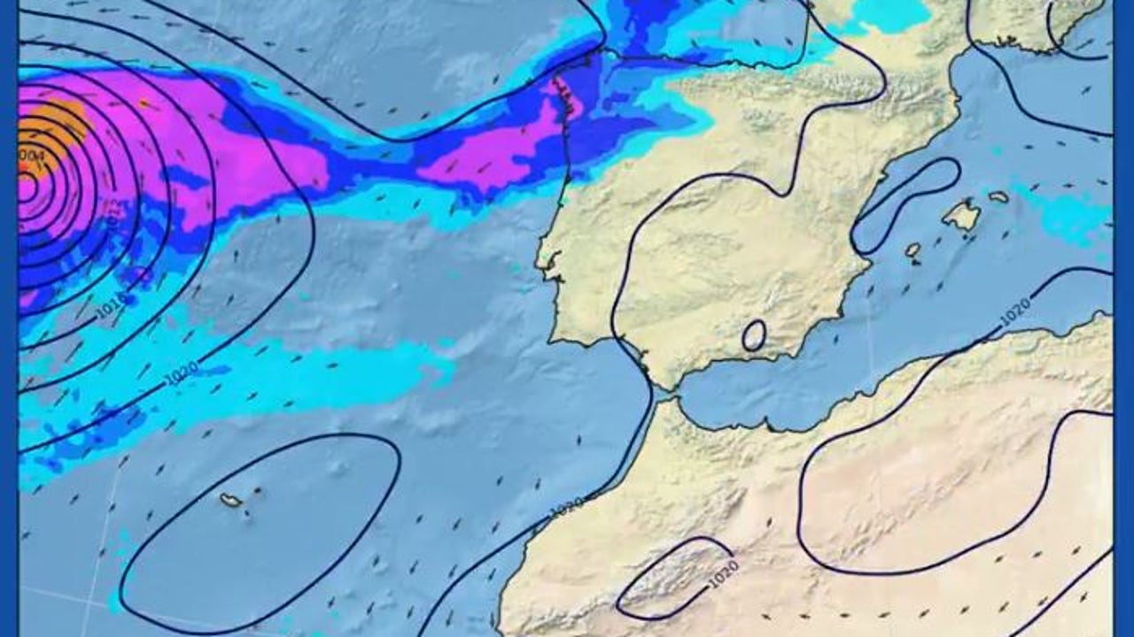
On the other hand, the weather of Meteored, Samuel Biener, has reported that Hurricane Gabrielle could reach the peninsular in the end converted into storms. Most weather models foresee their impact on the northeast peninsular during the weekend. The exhuracán will have similar effects to those of an Atlantic depression, that is, wind, maritime temporal in the north and rains.