
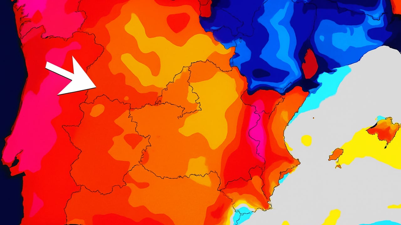
The heat wave that whips much of Spain Since the beginning of the week you have the days counted. Although This Tuesday and Wednesday will continue to be marked by extreme temperaturesespecially in the south and peninsular center, the State Meteorology Agency (Aemet) has announced the arrival of A trough which will break atmospheric stability from Friday, July 18.
This phenomenon will bring rains, storms and a Progressive descent of temperaturesespecially in the peninsular north.
Aemet warnings per heat in six communities: up to 41 ° C
The day on Tuesday has put in alert six autonomous communities by temperatures that exceed 40 degrees:
-
Andalusiain level orangewith maximum between 40 and 41 ºC In Córdoba, Jaén and Sevilla.
-
Cádiz, Granada, Huelva and Malagaat yellow level, with maximum 38 to 39 ºC.
-
Castilla-La Manchacompletely in Yellow warningby temperatures of 34 to 38 ºC.
-
Estremadurawith records up to 39 ºC.
-
Castilla y Leónespecially Ávila and Salamanca, where they will be achieved 37 ºC.
-
Madridalso at yellow level, foresees 37 ºC in the metropolitan area and 35 ºC in the Sierra.
-
Valencia Active yellow alert by maximum 36 ºC.
To this is added the African air that has reached the capital, increasing the dust in suspension and reducing air quality.
Wednesday and Thursday: suffocating heat and tropical minimum
He Wednesday 16 and the Thursday, July 17 They will keep the same meteorological pattern:
-
Mostly clear skies.
-
High minimal temperaturesbetween 20 and 22 ºC in areas of the center, south and Mediterranean coast.
-
Maximum 38 to 40 ° C in large areas of the peninsular interior.
-
Up to 43 ºC in the Valleys of the Tagus, Guadiana and Guadalquivirbeing Cordova One of the most critical points.
-
In Bilbao and the Eastern Cantabrianthe 30 ºCwith thermal ascents also in the northern cornice.
Despite this generalized heat, they could register Punctual storms in the afternoon in it Pyrenees and areas of. Iberian system.
Vaguada and thermal descent from Friday
From Friday, July 18the AEMET and other meteorological portals such as Eltiempo.es alert about the entrance of A small trough by Galiciawhich will bring with it:
-
Increasing atmospheric instability in the peninsular north.
-
Showers, storms and even hail Between Friday and Sunday in:
He Temperature decrease will begin in the northwest Friday and It will be extended towards the center and northeast on Saturday. However, in the Mediterranean slope will continue presentalthough with less intensity.
What time to wait for the weekend?
-
Friday 18: First day with Temperature descent in Galicia and Atlantic Environment. Possible scattered rains.
-
Saturday 19 and Sunday 20: More fresh in the north and peninsular center, with intermittent storms and cloudy skies in large zones.
-
In it Mediterranean coastespecially in areas such as Murcia, Alicante and Valencia, they will remain temperatures above 35 ºC.
Spain is going through one of the most intense episodes of summer heatwith Activated alerts and extreme temperatures in several communities. However, The entrance of a trough from the Atlantic will mark an important change of tendency As of Friday, returning some freshness to many regions and offering A thermal respite.
Until then, Caution is recommended to take effect Given the high temperatures, avoid outdoor activities in the central hours of the day, hydrate frequently and follow the Civil Protection and Aemet recommendations.