
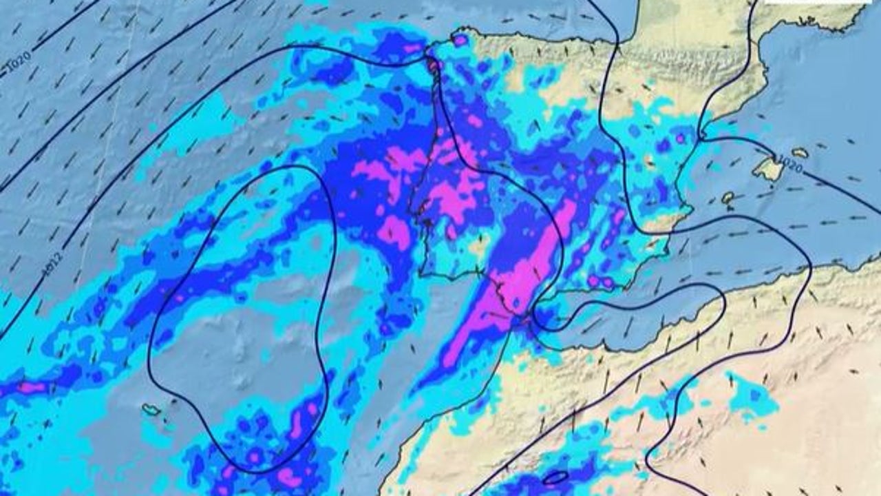
Olivier, the Thirteenth Borrasca of great impact this seasonwill arrive this Wednesday in the Canary Islands and Thursday to the Peninsula, accompanied by rains, storms and a notable decrease in temperatures, as reported on Monday the State Meteorology Agency (Aemet).
After a few days of atmospheric stability and May temperatures, Olivier will break the trend with Very strong showers in the Canary Islands, especially in the mountainous areas of La Palmawhere they can be persistent. In addition, they are expected intense wind gusts in the archipelago.
As of Thursday, Borrasca Olivier will move to the Peninsula And, although there is still uncertainty about its location, From that day rainfall could affect large areas of the countryespecially in the peninsular south and the Mediterranean area. In some regions are expected Storms and hail often, with special incidence in Andalusia, Murcia and the east coast.
With the arrival of the front, daytime temperatures They will descend between 6 and 8 degrees in the southern half. Thus, cities like Córdoba, Jaén or Malaga, that reached maximum above 25 degrees these days, will fall to values around 20–22 degrees. In the northwest the atmosphere will be warmer with values in Zamora of up to 25 degrees and between 26 and 28 degrees in Pontevedra or Ourense.
Until the arrival of Olivier, time will remain warm and stable in most of the country. This Tuesday, they are expected temperatures between 5 and 10 degrees above normal, with maximums of up to 28 ºC in Badajoz, Sevilla, Almería, Ourense and Pontevedra. However, already Wednesday An increase in instability in the north and this peninsular will be observed, with possible showers in Aragon, Catalonia and the Valencian Communityoccasionally accompanied by storm and hail.
Holy Week 2025 starts with rains
The first weekend of Holy Week will be “passed through water” in many areas of the country. On Friday the low pressures will cause in the country could cause a greater Increased instability in the peninsula with rains and showers, especially in the west and south of the territory, as well as in points of the Mediterranean area. “These showers can be locally intense,” says the Aemet. During the weekend the showers They could generalize being able to affect most of the peninsular territory.
As to Temperatures although “without being cold” will go down the weekend of Palm Sunday regarding previous days.