
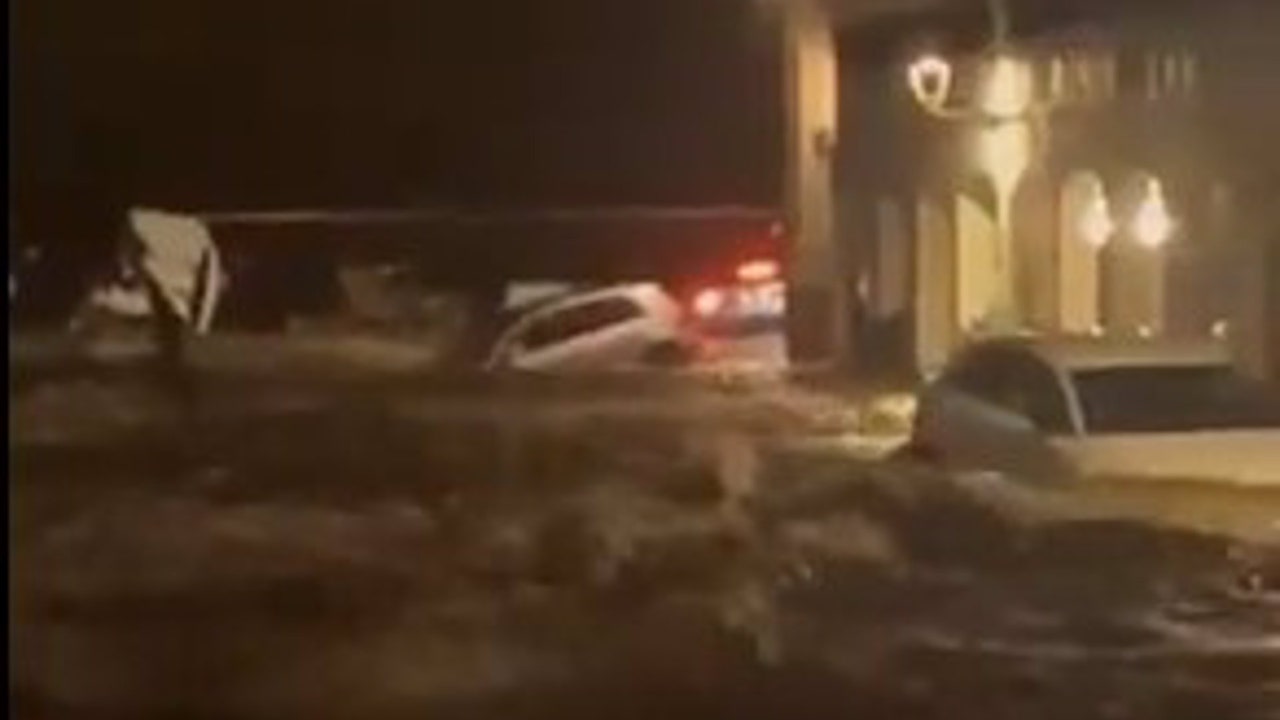
The rains will be concentrated this Friday in Catalonia, on a day in which strong gusts of wind will be recorded in Cádiz. The State Meteorological Agency (AEMET) has activated this Friday the orange alert in the province of Girona (Catalonia)where an accumulated precipitation of up to 40 liters per square meter is expected in one hour and up to 100 liters in 12 hours. The heavy rains already have caused significant damage, dragging around 30 vehicles on a boulevard in Cadaqués, in the Girona region of Alt Empordà.
According to AEMET, the most affected area is Empordà, which has recorded intense rainfall that reached 40 liters per square meter in less than an hour. However, it is expected that the intensity of the rain will begin to decrease throughout the morning, and that the orange alert in Girona will be lowered to yellow. starting at 10:00 a.m.s. During the yellow warning, accumulated precipitation could reach 20 liters per square meter in areas of Empordà, the pre-coastal, the southern coast and the eastern Pyrenees.
Strong flood in Cadaqués
During the early morning, a strong flood in a branch of Cadaqués swept away about 30 vehicles that were piled up under a bridge, without reaching the sea. Fortunately, no injuries have been reported.. The flood occurred around 3:54 a.m., and the Generalitat Firefighters sent two crews to the scene to deal with the situation.
Although this has been the only intervention of the firefighters in Alt Empordà, in The neighboring region of Baix Empordà also recorded up to eight emergency calls starting at 3:00 a.m.s, mainly rrelated to flooding in homes. No injuries were reported in these cases either. Civil Protection recommends that the population remain attentive to weather updates and to the instructions of the authorities to prevent any additional risk.
A new Atlantic front arrives
In general terms, the AEMET foresees the entry of a Atlantic front in the west of the peninsula, with increased cloudiness and precipitation in Galicia and the western Cantabrian Sea. It is not ruled out that they also occur in other areas of the northwest third and that they are more abundant in the northwest of Galicia. Likewise, the possibility of showers will persist in the Strait and eastern Mediterranean area which, in the early hours, may be accompanied by storms in the east of the Balearic Islands and in the northeast of Catalonia.
Regarding temperatures, will increase sharply in the Canary Islands, with values above normal on these dates. On the one hand, the maximums will decrease in the west of the peninsula and will increase in the northeast and the Balearic Islands. On the other hand, the minimums will drop in Galicia and in the eastern half. The provincial capitals that will register the highest values will be Las Palmas de Gran Canaria with 31ºC; Santa Cruz de Tenerife with 29ºC; and Alicante, Granada, Oviedo, Seville and Valencia with 23ºC.
Besides, Weak frosts are expected in the Pyrenees and probable haze in the eastern Canary Islandsas well as winds from the south component rolling to the west component in the Meseta, Galicia and, with strong intervals on the coasts, in the Cantabrian Sea. Meanwhile, it indicates that there will be intervals of strong easterly winds in the Strait, fading to weak winds and winds from east and north components rolling to the southwest in the eastern Mediterranean area and Alborán. In the rest of the Peninsula, there will be weak ones from the east and south. In the Canary Islands, they will be weak with an eastern component, more intense and with a southern component on summits.
Forecast for the weekend
Facing the weekend, although more stable weather is expected, some areas of the northern Mediterranean will continue to experience instability until Sunday. The AEMET has recommended that the population remain attentive to emergency indications, since, although the general meteorological risk will decrease, heavy rains could still pose a danger to certain activities and movements.