
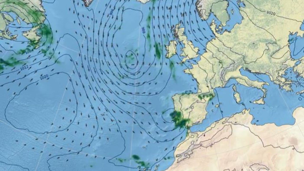
The remains of Hurricane LeslieThey will arrive this Tuesday as a storm on the Peninsula leaving rain in large areas of the country and temperatures that, although this Monday are expected to be warm, in the middle of the week they will be more autumnal, according to the prediction of the State Meteorological Agency (AEMET). By area, they will be abundant in the west of the peninsula, including Galicia, the central system and Western Andalusiaas well as in parts of the Pyrenees and the Canary Islands, where they could be intense on La Palma.
This monday sIt will be a day of transition, with mild temperatures that will rise slightly, and rain in Western Andalusia, especially intense in the Strait. In the Canary Islands, precipitation will be more frequent in the afternoon, especially on the more mountainous islands.
During the Tuesday, There will be precipitation in many areas, but the remains of Leslie will not be the only cause of these rains. “A deep area of low pressure in the Atlantic will also provide a lot of instability,” explains Rubén Del Campo, AEMET spokesperson, who emphasized that the rains on Wednesday and Thursday are associated with the Atlantic low pressure centered west of Ireland.
The rains will be more widespread and abundant in Andalusia, the eastern interior and the central system. In the Canary Islands, rainfall will continue to affect La Palma. Given this situation, Meteorology keeps the yellow warning for rain in five communities -Andalusia, Castilla-La Mancha, Castilla y León, Extremadura and Valencian Communitya- and on the island of La Palma, where between 15 and 20 liters per square meter in one hour or 40 liters in 12 hours are expected.
Strong winds will also blow in the northern mountains and Temperatures will drop, although in some cities such as Lleida and Palma de Mallorca they will still reach 28ºC and 30ºC, respectively.
For him Wednesday and Thursdayunstable weather will remain in most of the peninsula and the Canary Islands, with lintense rains in Extremadura, Western Andalusia, the central system and the Pyrenees. The wind will continue strong in the north and Temperatures will continue to drop, with chances of snow in the northern mountainsalthough without large accumulations. In the interior, temperatures will range between 15 and 18ºC, while in the Mediterranean they will remain above 25ºC.
From Fridaythere will be a trend towards a more stable situation with the rains subsiding, except in the northern third and the mountainous areas of the interior. Temperatures will begin to rise, becoming mild or warm again in some regions, reaching 30ºC in the southeast of the peninsula. In the Canary Islands, the trade winds will return strongly, bringing rain to the north of the mountainous islands and clearer skies in the south.
For its part, Eltiempo.es advances that the situation would begin to improve in the face of weekend, when with a ridge and the anticyclone they will advance from the southwest. Specifically, he has specified that Friday will be “a priori” the last day with significant rains. However, on Saturday there could still be rainfall in parts of the northern peninsula.
According to the meteorological portal, the southern face of the Pyrenees will be the area that accumulates the most liters throughout the week, exceeding the 160 liters per square meter (l/m2). In addition, the north of Cáceres, Sierra Morena and the west of Galicia are forecast to almost reach 100 l/m2.