
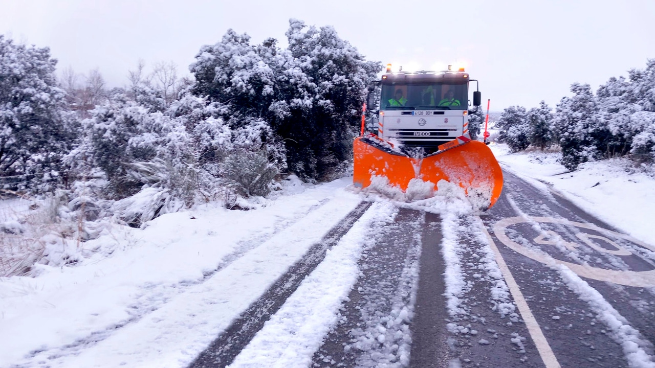
Spain faces this week a early winter episode due to the entry of a arctic air mass that will cause a sudden change in weatherwith widespread thermal drops, snowfall at low levels and a strong storm of wind and waves that will affect both the Peninsula and the Balearic Islands. The State Meteorological Agency (AEMET) and the General Directorate of Civil Protection and Emergencies have issued warnings and recommendations given the intensity of the phenomenon.
Notices this Tuesday
This Tuesday they were activated warnings for rainfall and waves in three provinces and Melilla. Girona is at orange level (important) for waves, with winds from the north and northwest of 60 to 75 kilometers per hour (km/h), gusts that can reach 90 km/h and waves of up to 4 meters. Mallorca, Menorca and Tarragona have yellow warnings for waves, while Mallorca and Ibiza and Formentera are under yellow warning for accumulations of more than 20 l/m2.
Even so, the weather will remain stable in much of the Peninsula, with slightly cloudy skies in the southern and northeastern half of the peninsula and with abundant low morning cloudiness in the rest. Only cloudy skies will persist in the extreme north of the Peninsula due to the entry of a humid flow from the north, with a probability of some weak and occasional precipitation in the Cantabrian Sea and northern Galicia.
In the Balearic Islands and Melilla, instability will continue, with showers that could be locally strong and accompanied by storms.and that can occasionally affect the Strait, the coasts of Catalonia and the southeast of the peninsula.
Maximum temperatures will drop noticeably in the north and in the Navarra area, while minimum temperatures will drop sharply in the center and northeast of the peninsula. Soria could reach –2 ºC, while in contrast the Canary Islands will maintain values of up to 24 ºC.
Wednesday: the Arctic air mass arrives
YesIt will be from Wednesday afternoon when the Peninsula fully receives the mass of arctic air. The humid flow from the north will give rise to snowfall in the Cantabrian mountain range and the Pyrenees, with a level that will drop to 800-1000 m at the end of the day. Frosts will begin to intensify, especially in the northern half.
Thursday and Friday: thermal collapse and snowfall at very low levels
Between Thursday and Friday the arctic air will extend throughout practically the entire Peninsula and Balearic Islandss. Maximum temperatures will remain below 10 ºC in large areas, with values between 5 and 10 ºC below normal for November. Frosts will be widespread, moderate and even locally strong in mountainous areas.
Snow will be the protagonist in the northern third, where the level will drop to 400–600 meters. In the Cantabrian Mountains, between 20 and 40 centimeters of snow could accumulate throughout the episode. Other mountains in the northern half will also receive snowfall, although weaker.
For its part, Meteored indicates that the European model predicts accumulations of more than 50 cm of snow in high areas exposed to the northern winds of the Cantabrian Mountains, more than 20 cm in the Pyrenean divide and more than 10 cm in the northern Iberian Peninsula. Furthermore, the meteorological portal indicates that in Cities like Segovia, Ávila or Burgos could see snow.
Very strong wind and maritime storm
The wind will be another significant phenomenon during this episode, increasing from the north since the late hours of Thursday, especially the Cerzo and the Tramontana. Very strong gusts are expected in the northeast of the peninsula, the Balearic Islands and also in mountain areas of the eastern third of the peninsula, with possible blizzards in the Pyrenees, especially during Friday and Saturday.. Added to this is an intense maritime storm that will affect the Balearic Sea and the Empordà.
Saturday: tendency to increase temperatures
Starting on Saturday, although with uncertainty, the most likely scenario points to the entry of a warmer Atlantic air mass that will raise temperatures and snow levels. Snowfall and frost will be restricted to mountain areas in later days.
Civil Protection Recommendations
The General Directorate of Civil Protection and Emergencies recommends taking extreme precautions from this Tuesday. In a statement, it asks to avoid trips and, if it is essential to make them by road, to consult beforehand the weather situation and the state of the roads, especially due to the presence of ice patches.
It is recommended to check the tires and wear winter tires or chains, monitor the antifreeze, the vehicle’s brakes, and fill the fuel tank. Also, bring warm clothing and a mobile phone with a spare battery and/or car charger. If you get stuck in the snow, it is recommended to stay in the vehicle with the heating on, renewing the air from time to time, and make sure that the exhaust pipe is not blocked to prevent gases from penetrating the interior.
In the event of strong gusts of wind, it is recommended to secure doors, windows and all objects that may fall onto public roads and stay away from cornices, trees, walls or buildings under construction or cranes that may become detached. On the road, ask for extreme caution, especially when exiting tunnels, overtaking and crossing heavy vehicles. In maritime areas, remember that the waves can acquire extraordinary conditions and drag anyone who approaches the coastline, so they ask you to stay away from beaches, breakwaters and low areas.