
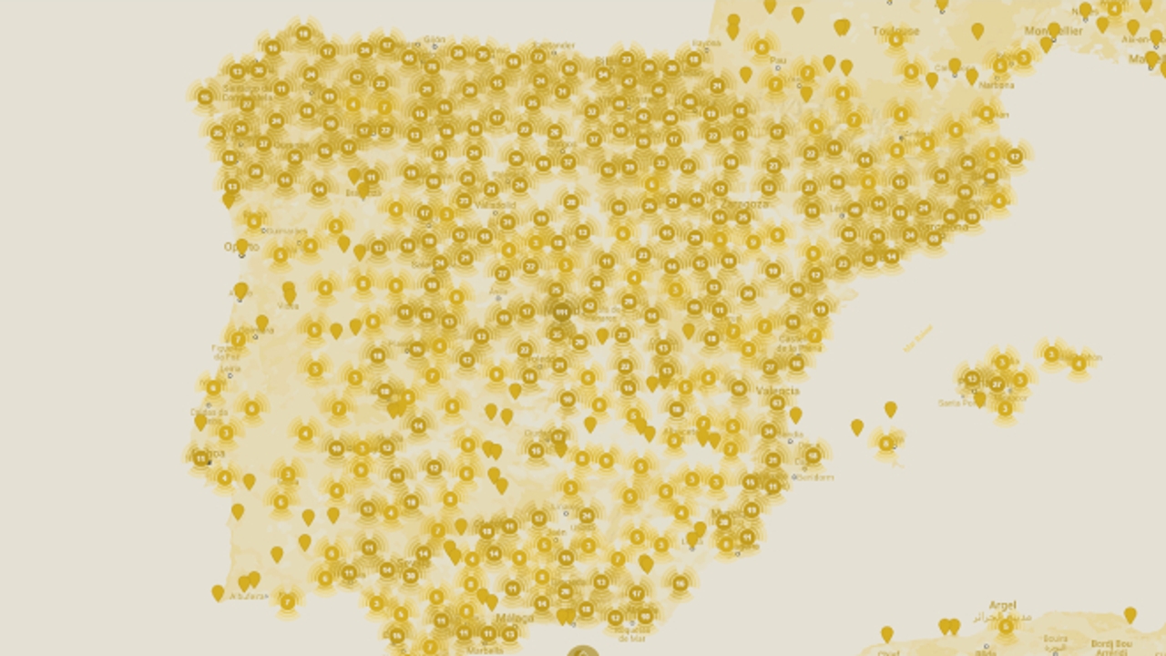
If you want to delve into history through any of the multiple maps that classify different types of data, you will not lack options, but you will not find none of the magnitude offered by the Hispanic History portal. This 'Google Maps' of the history of Spain geoposition an enormous number of events and characters and relates them to each other on a scale that had not been done until now.
In total, about 50,000 characters, 20,000 events and 150,000 geographical references all over the world. This is a project that started a year ago and made Spain the first country in the world to have its history georeferenced. From the year 1,350,000 BC to the present.
Behind the portal with the most information on Hispanic history that can be found is the Royal Academy of History, an institution that has received funding from the Ministry of Science and Innovation for this project. Contrary to what happens in many interactive maps, which draw on sources such as Wikipedia or user collaborations for the content.Hispanic History offers its own that has been carried out by academics, historians and specialists. For this project, The Royal Academy of History has updated the contents of the Electronic Biographical Dictionary (2018) and has reviewed, expanded and updated the information on historical events that made up the Chronological Atlas of the History of Spain (2008).
The quality of the information collected by Hispanic History is endorsed by more than 500 scientific institutions national and international organizations that have collaborated in the development and implementation of this database and those close to 5,000 historians and researchers Spaniards and foreigners who have contributed to developing the contents.
How to use the 'Google Maps' of the Royal Academy of History
The operation of Historia Hispánica, which uses Google Maps technology, is very intuitive and all the information is linked so that it always responds to the who (characters), when (epochs), where (places) and that (topics). The user can begin the exploration through any of these parameters, at the bottom of the map, or more intuitively by zooming in on a specific area and selecting the marker of interest.
Clicking on it opens a window with three tabs that show the births, deaths and events at that point. By selecting the name of the character or the event collected, the map redirects to the corresponding tab with in-depth explanations.
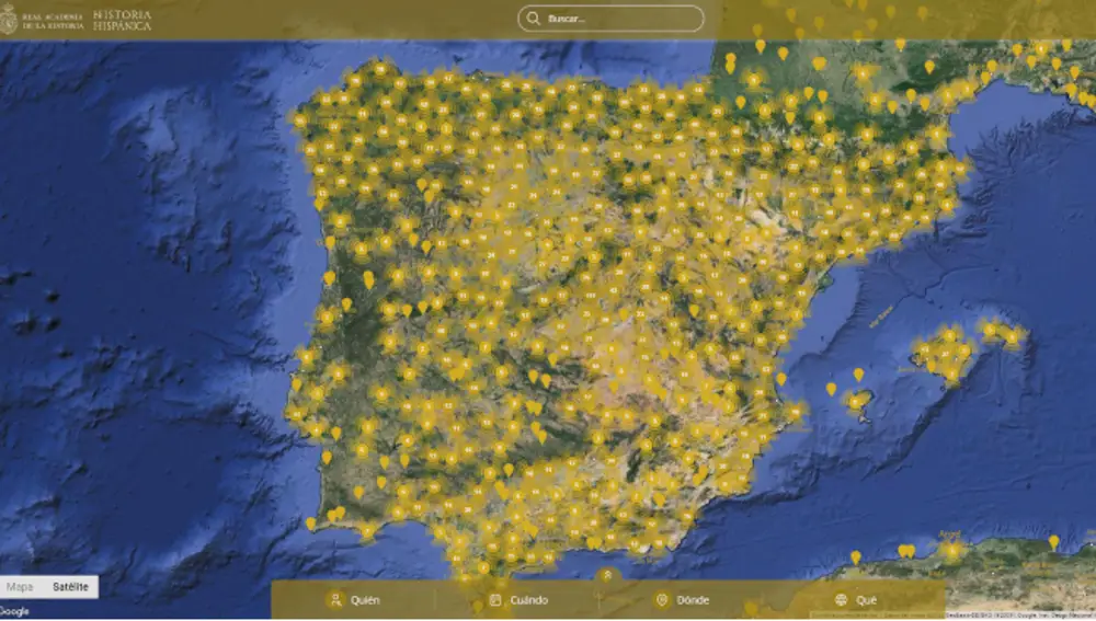
The map also supports satellite view and has a timeline which allows you to choose a specific year, between 1,350,000 BC and 2024, to see which characters and events took place in it. You can visit Hispanic History by clicking here.