
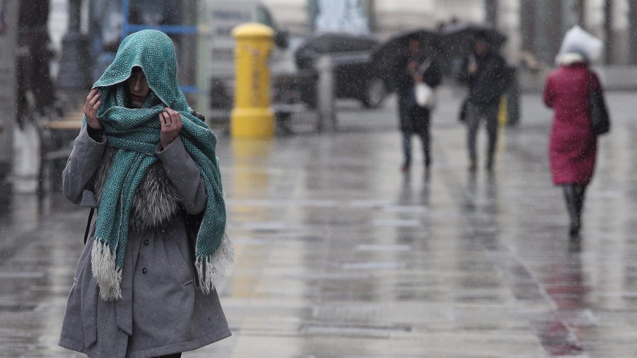
He returns winter weather to many areas of Spain. A pocket of very cold air will leave winter values starting this Monday. The drop in temperatures will be pronounced in the northern half, especially the maximums, which will be in many points 8 to 10 degrees lower than Sunday and they will barely be above 15 degrees in the interior of the northern half, according to the forecast of the State Meteorological Agency (AEMET).
The joint action of a anticyclone located northwest of Europe and from one storm that will develop over the western and central Mediterranean, will cause the irruption of an arctic air mass which will cause a marked temperature drop in the Peninsula and the Balearic Islands. Thus, temperatures will plummet this Monday in much of the interior of the northern half of the peninsula, this drop being especially pronounced in Aragon, eastern Castilla y León, northern Madrid and Castilla-La Mancha and northwest Cataloniaand are expected locally heavy rainfall in eastern Catalonia.
Temperatures will decrease in the northern half of the peninsula, the central zone and the Balearic Islands, with the decrease being notable in areas of the northeast quadrant of the peninsula; on the rise in Andalusia, and with few changes in the rest. There will be frost weak in mountain areas of the northern peninsula, more intense in the Pyrenees and without ruling out that they extend to areas of the mountainous environments and northern plateau. Furthermore, the AEMET has activated andhe orange warning for waves in Catalonia, specifically in Girona, which will also have yellow warnings for rain, wind and storms. For its part, Galicia has a yellow warning for waves and Zaragoza for wind.
The skies will be cloudy in the northeast of the peninsula and in the Balearic archipelago, with precipitations that will extend to the rest of the Levantine area and southeast third of the peninsula, and may be accompanied by storm especially during the afternoon and they could be locally strong in the east of Catalonia. Likewise, there will also be cloudy skies or with cloudy intervals on the Cantabrian slope, upper Ebro, northern Iberia and the Pyrenees, with the possibility of weak rainfall, with a predominance of slightly cloudy or clear skies in the rest of the Peninsula. In the Canary Islands, there will be cloudy intervals in the north of the islands, without ruling out weak rainfall in those with greater relief, and little cloudiness in the south.
In the surroundings of the Pyrenees and in the interior of Catalonia The snow level will be low for this time of year about 700 meterswhile winds from the north will blow in the northern half of the peninsula, the central area, the Balearic Islands and the Canary Islands, with strong intervals on the northwest coast of Galicia and Ampurdán and of variable direction in the rest.
Tuesday, the coldest day
The AEMET predicts that tomorrow Tuesday is the peak day of this cold episode, with significantly low minimum temperatures for this time of year. The decreases in maximum temperatures will continue, although less pronounced and extending to areas of the southern half of the peninsula. In Pamplona, Vitoria, Burgos, Ávila, Segovia or Soria, daytime temperatures will be below 10 degreesand with the wind intensifying the feeling of cold.
The minimum temperatures will also drop generally in the interior of the peninsula. They wait frost in high areas of the northern half, large areas of Castilla y León, north and east of Castilla-La Mancha, the south of Aragon, as well as the Pyreneeswhere locally they can be strong.
During the second half of the day, the Atlantic anticyclone will move towards the southwest, so it is likely that the emergence of very cold northern air will cease and therefore this episode will end, with a general rise in temperatures starting Wednesdayalthough the minimums can still be significantly low around the Pyrenean area during this day.
Storm during the final stretch of the week
He Thursday It will be a day of transition before the arrival of a great storm of Atlantic origin, reports eltiempo.es. The meteorological information portal warns that the first front associated with this storm is expected on Friday and will open the door to colder air that will creep into the northwest over the weekend. The rainfall associated with this storm will arrive from Friday to Sunday, affecting mainly the northwest and north, although it is not ruled out that it will reach other areas of the center and south.