
Francis, Goretti, Harry, Ingrid, Joseph, Kristin, Leonardo, Marta, Nils. Since October 2025, the Iberian Peninsula has become an exceptional destination for Atlantic storms. When one of them is named it is because it is expected to cause orange level warnings, that is, significant risks due to wind, rain or snow. The situation has intensified since December with the arrival of Francis; In a month and a half it is difficult to find more than two days without precipitation or intense cold in any region. And we have already added eight storms in a row.
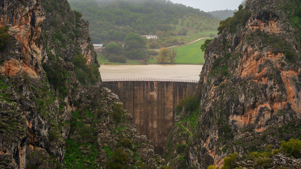
This “carousel” is leaving unusual images. In Ubrique (Cádiz), the streets have been transformed into improvised waterfalls. In Malaga, the call Montejaque ghost dam, an infrastructure that never functioned and that just three years ago was empty, is now the reason for the eviction of several towns due to the risk of overflow.
Scientists insist that what we experienced this winter is unusual, but why is that? The origin, they explain, must be sought in the polar jet. «The explanation lies in how the atmosphere has been organized on a large scale during these weeks. We can imagine the Atlantic as a huge highway on which storms travel. This winter, that highway has been practically open continuously towards the Iberian Peninsula, allowing the storms to arrive one after another without a break. This has happened because the polar jet stream, the great river of wind that directs storms, has remained very active and especially wavy. When it waves, the storms tend to circulate at lower latitudes than usual, that is, closer to Spain, instead of moving towards northern Europe,” explains Mar Gómez, doctor in Physics and head of meteorology at eltiempo.es.
Meanwhile, in the Arctic area the opposite has happened: an anticyclone has been installed. «It is unusual for the polar vortex to deviate so far south. The configuration it has had is like a kind of ribbon, a corridor of storms, which has entered continuously and directly, while in the Arctic an anticyclone has been installed, which is usually located in our latitudes and, during this month and a half, the circulation has been reversed. The Arctic has not had large snowfalls. That is the unique thing about this winter,” says Jorge Olcina, professor of Regional Geographic Analysis at the University of Alicante. The researcher remembers similar episodes from the past. «The drought of the early 90s ended in the winter of 1995 with a succession of storms. There weren’t many, but they arrived very loaded with water. But To find a comparable episode you have to go back almost 30 years. In Grazalema, one of the rainiest points in Spain, in 1963 more than 4,300 liters per square meter were recorded in a single year, an exceptional figure.
On the other side of the Atlantic, New York has recorded historic snowfall, with accumulations not seen for more than 120 years. A situation that Donald Trump has taken advantage of to question climate change and challenge those he calls “warm scientists.” But does science relate these episodes to climate change? The first thing those consulted ask for is caution. «It is important to be rigorous. There is still no specific attribution study for this specific episode and, to be able to say this with certainty, it would be necessary to carry out this detailed analysis. An isolated episode, heavy rain or a cold wave does not alone demonstrate the effect of climate change. What we do know, with sufficient scientific solidity, is that global warming is modifying the background conditions of the atmosphere. A warmer atmosphere can hold more water vapor, 7% more for every degree increase in temperature. This means that, when dynamic conditions favor the formation of storms, there is more moisture available, that is, more “fuel” for intense precipitation. Climate change does not create a specific storm nor does it alone determine the trajectory of the polar jet, but it can intensify the associated impacts,” says Mar Gómez.
January 2026 has been the coldest in the last decade, according to Copernicus data. However, it was approximately 1.47 ºC above the average for the pre-industrial period (1850-1900). “Although there may be monthly variability and cold episodes in certain areas, the climate system as a whole continues to show high values on a global scale,” notes The Guardian. Copernicus also offers data globally. While Europe recorded lower temperatures in January, most of the planet presented values above average, especially in the Arctic, Greenland or Russia, Australia and Antarctica. Extreme phenomena have occurred in the southern hemisphere: record heat with forest fires in Australia, Chile and Patagonia, and heavy rains in southern Africa, especially in Mozambique. “The average sea surface temperature was 20.68ºC, the fourth highest value recorded for the month of January, only 0.29ºC below the 2024 record,” the report says.
The anticyclone returns
Jorge Olcina admits that at first The idea that climate change would mean that it would no longer be cold or snow was poorly conveyed. «What happens is that it is a cold that is no longer as intense, but there are more torrential snowfalls, as happened with Filomena. Now we have had, in just a month and a half, six or seven storms, and all of them have left abundant rain and snow. In addition, he points out that starting next week the Azores anticyclone will begin to gain latitude and move over the Iberian Peninsula. «That means that the rains are going to stop. Temperatures will rise moderately, although the winter anticyclones favor cold nights,” comments the professor.
Time to act
Now that the flow of the reservoirs exceeds 76% of their capacity and in Andalusia there is 40% more water stored than a year ago, “it is time to propose effective water planning in Spain and not wait for the next dry cycle.” “Let’s propose a water scheme until at least 2050, which gives us security,” asks Jorge Olcina. A Greenpeace statement published this week points along the same lines. “The past is no longer a guide to the future,” he says, pointing out the need to apply forest management and hydrological restoration measures, territorial planning and application of environmental regulations. “The need for these measures is becoming increasingly evident,” they conclude.