
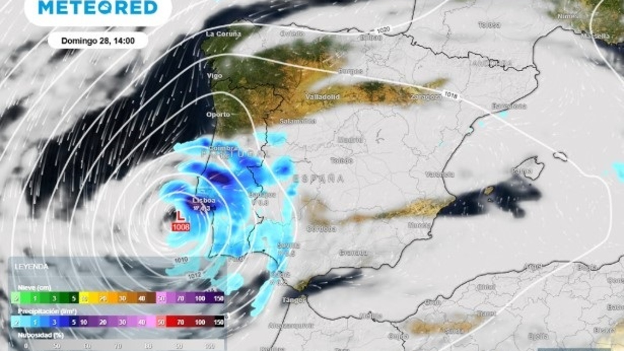
The last weekend of September, coinciding with the “summer of San Miguel” will be dominated by the sun and softer temperatures. However, from Sunday, the Hurricane Gabrielle approach, already turned into extroatropical stormIt will leave heavy rains, wind and strong waves in several areas of the country.
Samuel Biener, a weather climate, has advanced that, according to the European model, ‘Gabrielle’ will become a more typical storm of these latitudes. On the other hand, the Aemet front maps show that Gabrielle would lose their tropical cyclone status quite before reaching the peninsula. “Borrasca would acquire fronts of middle latitudes and lose its characteristic central eye,” according to the meteorological information portal.
Although Gabrielle will not come as a hurricane, that does not make it a harmless system. The models indicate that it will leave a storm of rain that will affect the peninsular southwest during the second half of Sunday.
The most affected areas
Although Exagabrielle’s trajectory still presents some uncertainty, the first point of impact on the Peninsula will be expected to be the Portugal coast, according to Duncan Wingen, meteorologist of Meteored. After, “Depression would run through the Gulf of Cádiz, affecting the coast of Huelva and Cádiz with strengths of strong, maritime temporal and abundant rains“He adds.
The effects of storm could extend beyond the southwest peninsular. According to the expert, they could also occur strong showers and storms on the coast of the east peninsular and in the BalearerS, due to the interaction of cold air at average levels of the troposphere and high temperatures of sea water.
And after Sunday?
Storch will weaken rapidly when crossing the peninsula or narrow, but it is not ruled out that its remains, a cold air embolism in height and a well -marked flow of lift due to the Scandinavian block, give rise to An episode of locally intense rainfall in the early next week in the environment of the Strait and in other Mediterranean communities.