
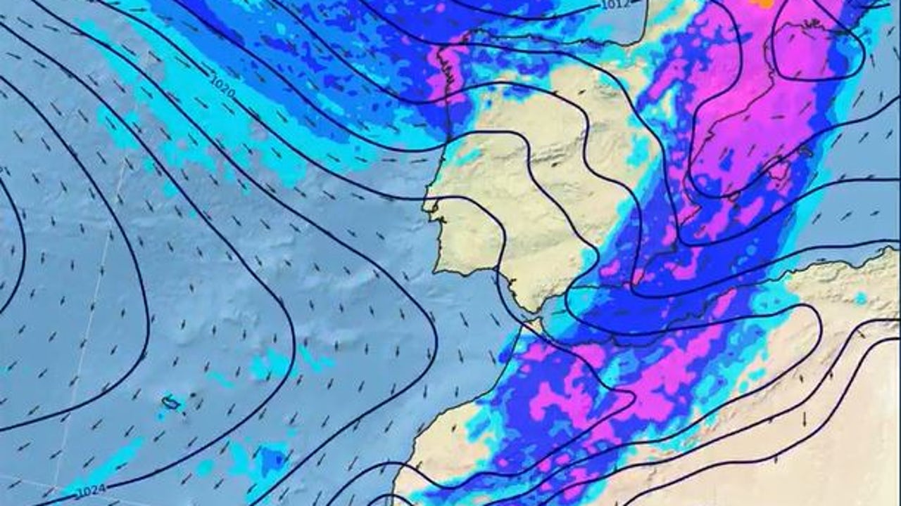
This Thursday, a new Atlantic Front will begin to enter through the northeast of the Peninsula, leavingor rains, strong wind gusts and storms in several areas of the country. At the same time, a generalized thermal ascentwith especially high temperatures in the south and east peninsular.
Extreme heat warnings
Heat will be intense in the Valencia and Andalusia Community. The State Meteorology Agency (AEMET) has activated Yellow notices due to high temperatures in the province of Valencia, where the maximums will range between 36 and 38 degrees. In the Guadalquivir Valley, 35 degrees could be exceeded.
In contrast, temperatures are expected to remain unchanged or descend slightly in Galicia, Alborán and coastal southeast and will have few variations in the Canary Islands.
Rains in northeastern peninsular
On the other hand, with the arrival of the front, the AEMET maintains active yellow warnings for rains and storms. Three Provinces of the East Peninsular – Girona, Tarragona and Castellón- continue today on alert for storm risk and intense rainfall.
In Catalonia, the alert affects areas of the Pyrenees of Girona and on the coast and the southern prelitorral of the province of Tarragona, where the rains will leave 20 liters per square meter in an hour at a time included Between 2:00 p.m. and 11:00 p.m. peninsular. Precipitation could be accompanied by storms.
Storm Fridays in these areas
On Friday, temperatures will go down in the Mediterranean and the Balearic Islands, while in the west of the Peninsula they will rise. The 30-32ºC will be exceeded in large areas of the north, between 32-34ºC in the center and between 34-36ºC in much of the southern half. In the Guadalquivir Valley they can even exceed 36ºC.
The front will move away through the Mediterranean, but the atmosphere will remain unstable in the Mediterranean area. At dawn, locally strong storms could occur in Catalonia, southern Aragon, Valencian Community and also in the Balearic Islands.
Hot Saturday with few rains
On Saturday, temperatures will rise in most of the country, which will be quite marked in the Cantabrian by the arrival of South winds. It is expected that the 30-32ºC be exceeded in the Peninsula and the 32-34ºC in large areas of the north and the Balearic Islands.
In cities like Oviedo or Santander, the maximum could reach 33-34ºC, while in Bilbao the 35ºC could be exceeded. In large part of the central and southern peninsular, 34-36ºC are expected, and in the Guadalquivir Valley, cities like Córdoba could reach 38ºC.
As for the rains, they will be scarce except in Galicia, where the arrival of a new front could leave rainfall.
A new front arrives
For Sunday, it is expected that this front that on Saturday entered through Galicia continues its progress from west to east, leaving Abundant rainfall in Galicia, which will extend to Asturias and northwest of Castilla y León.
Temperatures will descend significantly in these regions, while in the Mediterranean communities and in the Balearic Islands could rise and exceed 35ºC.